

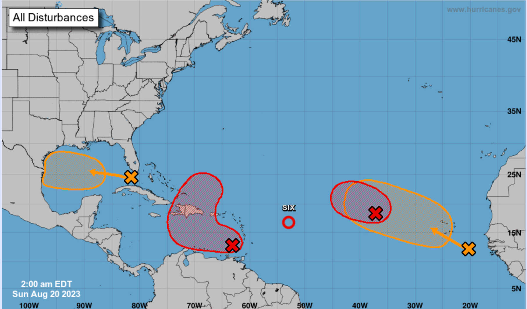
The National Weather Service in San Juan has issued a new advisory warning for deteriorating weather conditions affecting the U.S. Virgin Islands and Puerto Rico. A moderate to strong northeast wind flow is expected to persist throughout the day, owing to high pressure across the west central Atlantic and the approaching tropical wave AL90.

Increasing Threat of Flash Floods and Mudslides
Starting late tonight, the cloudiness along with showers and thunderstorms associated with AL90 are predicted to increase and spread across both Puerto Rico and the U.S. Virgin Islands. This weather is anticipated to last through the middle of the upcoming workweek. The expected rains significantly elevate the risk for urban and small stream flooding, as well as flash flooding, mudslides, and rapid river rises. Residents are urged to monitor the progress of AL90, which has a medium to high chance for development within the next 2-7 days according to the latest tropical weather outlook issued by the National Hurricane Center in Miami.
Short-term Forecast: Light Showers to Heavier Rainfall

Earlier today, light passing showers were observed across Puerto Rico and St. Croix, offering minimal rain. Today's weather conditions, which include windy conditions up to 20 mph with gusts up to 25 mph, are expected to be the driest for the next several days. A seasonal pattern of passing showers is expected, most likely followed by afternoon convection across southwestern Puerto Rico. However, weather conditions are predicted to deteriorate overnight as AL90 approaches.
A Wet Week Ahead
With AL90 moving closer, the eastern half of the region is expected to receive a significant amount of rain starting on Monday, worsening as the night approaches. This is expected to cause hazardous conditions such as flash flooding, mudslides, strong wind gusts, and frequent lightning. Therefore, a moderate flood risk threat has been issued for the U.S. Virgin Islands, Culebra, Vieques, and the east, south, and southeast sections of Puerto Rico.
Long-term Outlook: Continuing Risks
While models continue to disagree on long-term conditions, the general pattern suggests a moist and unstable environment lingering across the region through at least Thursday. This will lead to a continued potential for showers and thunderstorm development across the islands and coastal waters. By the weekend, the weather is expected to revert to a more typical summertime pattern, hot and humid with lesser chances of shower and thunderstorm development.
Advisory for Mariners

For the marine environment, choppy to hazardous conditions are expected for small craft, with building seas up to 7 feet and winds between 25-30 knots. Small Craft Advisories will be in effect through at least Tuesday evening.