




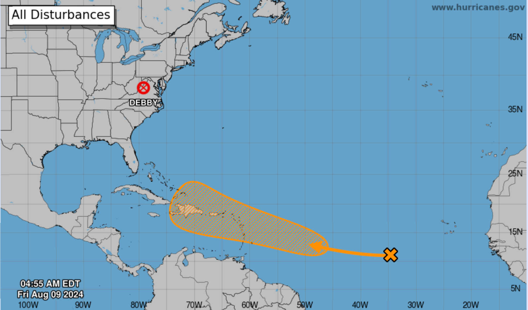
The National Hurricane Center is closely monitoring a tropical wave over the tropical Atlantic, located several hundred miles west-southwest of the Cabo Verde Islands. This system is producing widespread disorganized showers and thunderstorms as it moves westward across the central tropical Atlantic.

According to the NHC's 2:00 a.m. forecast on Friday, development of the wave is expected to be slow over the next couple of days. However, conditions are anticipated to become more favorable for development later, and a tropical depression could potentially form as the system approaches the Lesser Antilles by early next week.
The forecast predicts that the system will then move generally west-northwestward, with a potential approach to the Greater Antilles by the middle of next week.
- Formation chance through 48 hours: Low, near 0 percent.
- Formation chance through 7 days: Medium, 50 percent.

Residents and travelers in the Lesser and Greater Antilles are advised to stay informed about the progress of this system. The National Hurricane Center will continue to provide updates and advisories as the situation develops.