


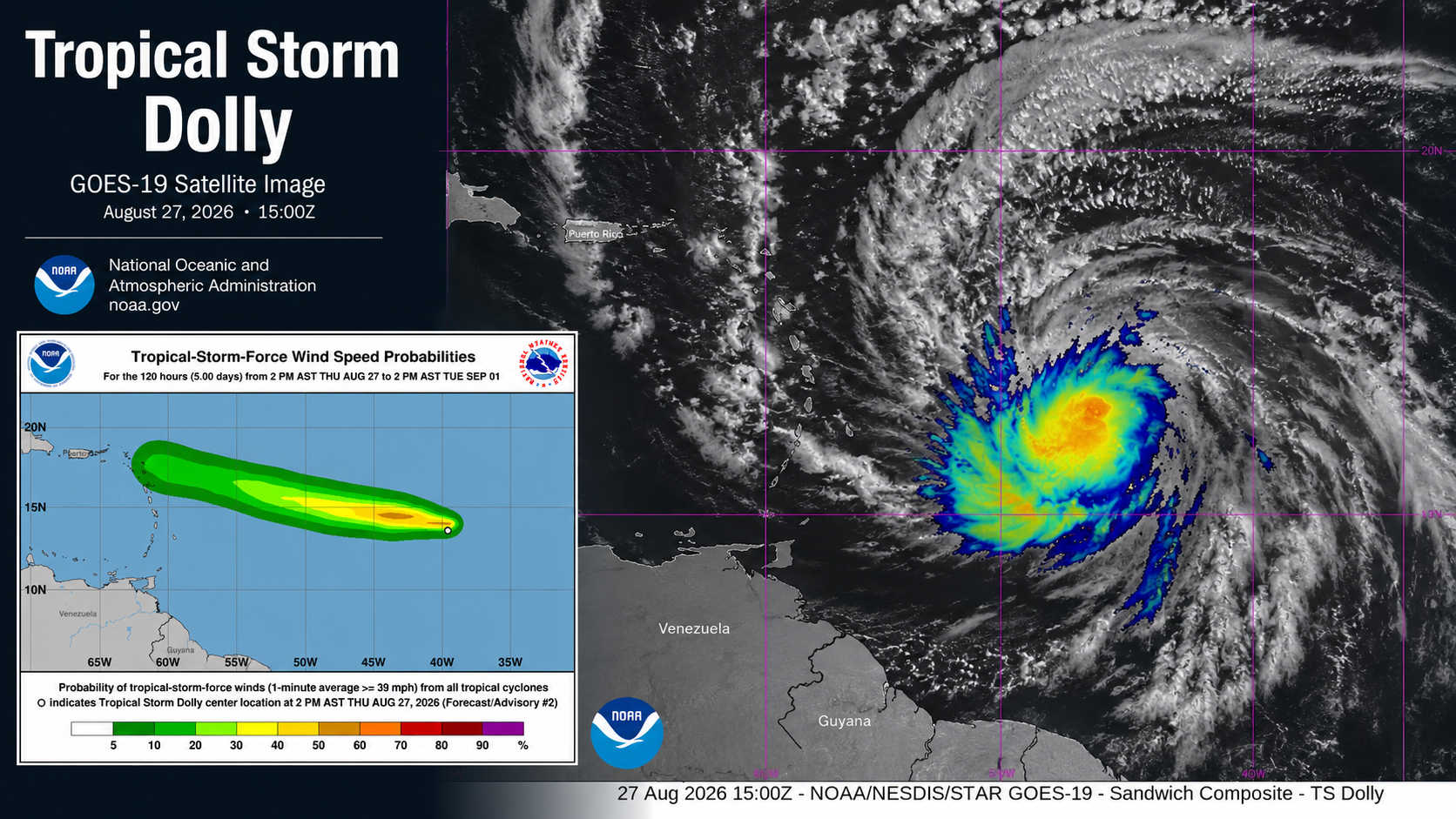
Tropical Storm Dolly formed over the central tropical Atlantic Thursday and was racing westward at 24 mph Thursday evening, with forecasters expecting the system to weaken before reaching the Leeward Islands but warning that its moisture could bring heavy rainfall into the U.S. Virgin Islands Sunday and Monday.

At 5:00 p.m. AST, the National Hurricane Center placed Dolly’s center near latitude 13.7 North, longitude 40.7 West, approximately 1,425 miles east of the Leeward Islands. Maximum sustained winds were near 40 mph, with higher gusts, while tropical-storm-force winds extended outward up to 60 miles from the center.
There were no tropical cyclone watches or warnings in effect, and the National Weather Service in San Juan said none had been issued for Puerto Rico or the U.S. Virgin Islands as of the 5 p.m. update.
Dolly was moving due west near 24 mph, and that rapid motion is expected to continue over the next couple of days. On the current forecast track, the system should approach the Leeward Islands during the weekend.

However, forecasters do not currently expect Dolly to maintain tropical-storm status through that approach.
Little change in strength is anticipated during the next 48 hours, after which Dolly is forecast to deteriorate into a tropical wave before reaching the Leeward Islands. NWS San Juan emphasized Thursday evening that the storm is expected to weaken before reaching the islands and said there was no tropical cyclone watch or warning in effect for Puerto Rico or the USVI.
The rainfall threat nevertheless bears watching.
According to the National Hurricane Center, heavy rainfall associated with Dolly could begin affecting the Leeward Islands from late Saturday into Sunday before spreading westward toward the Virgin Islands, Puerto Rico and Hispaniola Sunday and Monday. The NHC said the heavier rainfall could produce flash flooding, particularly across higher terrain in the Leeward Islands.
The system’s evolution will therefore be important for the Virgin Islands even if Dolly loses its closed tropical circulation before reaching the northeastern Caribbean. A weakening tropical cyclone can continue carrying substantial moisture capable of producing periods of heavy rainfall after its winds diminish.

NWS San Juan urged residents to continue following official updates from the National Hurricane Center and the local forecast office, cautioning against relying on individual computer-model runs or unofficial forecasts as Dolly approaches the region.