


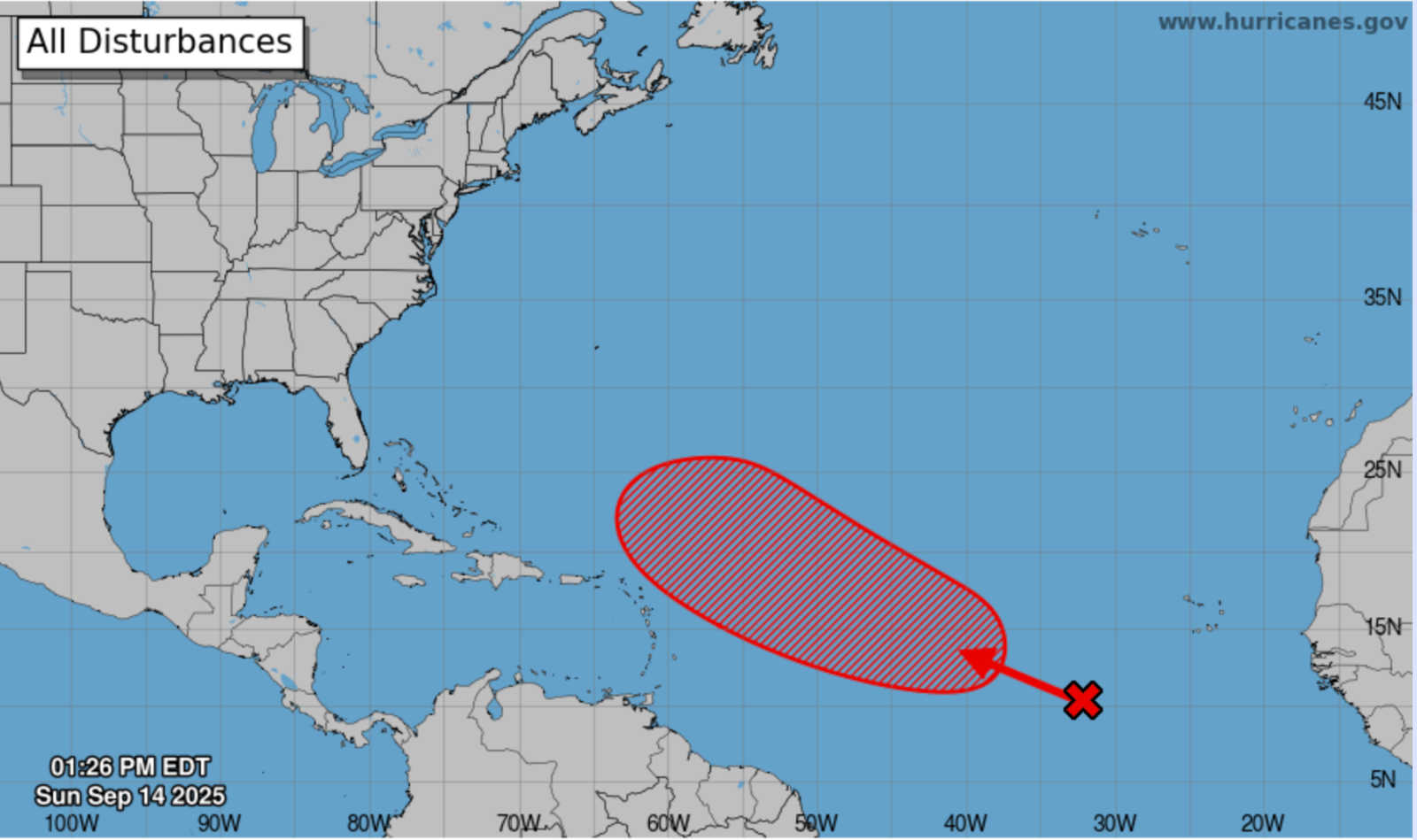
The National Hurricane Center (NHC) on Sunday increased the chances that a tropical wave in the eastern and central Atlantic will develop into a tropical depression this week, raising the formation probability to 20 percent within 48 hours and 70 percent within seven days. The disturbance is moving west-northwest at 10 to 15 mph and, if gradual organization continues, could become a depression by mid- to late week .

In its 2 p.m. Tropical Weather Outlook, the NHC said the wave is producing a broad area of disorganized showers and thunderstorms. While dry and stable air should inhibit development briefly, forecasters expect conditions to improve for organization after about a day. The system, tagged Invest AL99 earlier, remains poorly organized, and the NHC has shifted its attention to this main tropical wave as the only system of concern for now .
Ensemble models from the European ECMWF and U.S. GFS indicate the system is most likely to track north of the Leeward Islands. However, some scenarios bring it closer to the region, prompting vigilance for residents of Puerto Rico and the U.S. Virgin Islands. Even if the center remains north, rain bands, gusty winds, and rough seas could still reach St. Thomas, St. John, St. Croix, and Puerto Rico late this weekend into early next week. Mariners should prepare for swells and rip currents ahead of the system’s passage .
Local Impacts and NWS Outlook
The National Weather Service in San Juan reported that multiple tropical waves will keep the region unsettled through midweek. With soils already saturated, flooding risks remain elevated. A wave crossing the islands today and another atmospheric disturbance expected Monday are forecast to deliver heavy rainfall, thunderstorms, frequent lightning, and gusty winds. Urban and small stream flooding, rapid river rises, and landslides are possible through Tuesday, while moderate rip-current risks continue at many beaches .
Later in the week, an upper-level trough interacting with another wave is likely to sustain showers and thunderstorms through Thursday. Some drying may follow by the weekend as the main system moves northwest, though heat indices could rise to levels that may trigger heat advisories .
Three-Day Forecast
-
San Juan, Puerto Rico:
-
Mon (Sept. 15): High near 88°F, low 80°F. Scattered showers early, widespread thunderstorms in the afternoon. Heat index up to 102°F. East winds 7–14 mph. Rain chance 70%, with 1–2 inches possible.
-
Tue (Sept. 16): High 89°F, low 79°F. Scattered afternoon showers and storms. East winds 10–15 mph. Rain chance 60%.
-
Wed (Sept. 17): High 88°F, low 77°F. Mostly cloudy, showers likely after noon. East winds 5–13 mph. Rain chance 60%.
-
-
St. Thomas, U.S. Virgin Islands:
Forecasts indicate passing showers and thunderstorms each day, with highs in the upper 80s and lows around 80–81°F. Monday will bring mostly cloudy skies with passing showers. Tuesday calls for isolated thunderstorms, and Wednesday shows more storms and overcast skies. Rain chances range from 50 to 70 percent, with winds steady at 15–20 mph.

The NHC now expects the tropical wave to gradually organize and potentially become a tropical depression this week. While the most likely track keeps the system north of the Leeward Islands, Puerto Rico and the U.S. Virgin Islands could still see heavy rain, thunderstorms, gusty winds, and hazardous seas. With saturated soils and flooding already a concern, residents are urged to stay alert to official forecasts and updates as hurricane season continues.


Advertisements


