


The NHC's Sept. 2, 2025 outlook highlights a tropical wave south of Cabo Verde with a high (>60%) chance of development over the next seven days as it moves westward across the Atlantic. Photo Credit: NHC.
A tropical wave south of the Cabo Verde Islands is showing increased chances of development as it moves westward across the Atlantic, though conditions in the Virgin Islands and Puerto Rico remain calm for now.

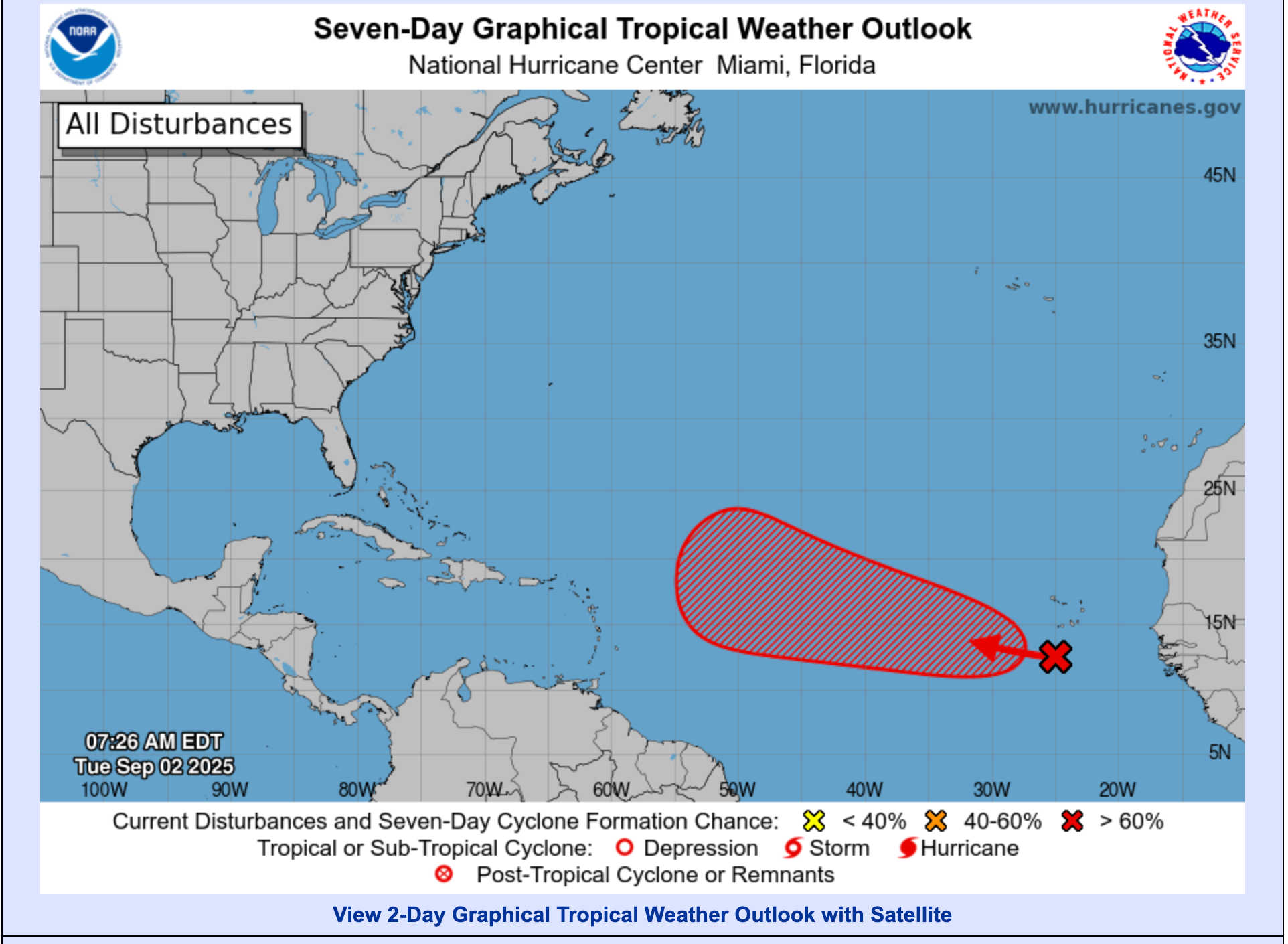
In its 8:00 a.m. EDT update on Tuesday, September 2, the National Hurricane Center (NHC) reported that the wave has become more organized and now has a 30 percent chance of formation within the next two days, and a 70 percent chance within seven days. The disturbance continues to produce disorganized showers and thunderstorms, but forecasters say environmental conditions remain favorable for gradual development. A tropical depression could form later this week or over the weekend as the system tracks west to west-northwest at about 15 mph.
The U.S. Virgin Islands and Puerto Rico are experiencing typical late-summer weather with trade-wind showers and heat.
-
St. Thomas and St. John: Expect a variably cloudy morning turning mostly cloudy this afternoon with scattered showers and isolated thunderstorms. Highs near 90°F and southeast winds around 15 mph are forecast. Tonight, showers remain possible (50 percent chance) with lows near 82°F. Breezy conditions continue mid-week, with highs of 89–91°F and rain chances of 30–50 percent.
-
St. Croix: Scattered showers and isolated thunderstorms are likely today with highs near 92°F, cooling slightly later in the day. Southeast winds of 10–15 mph are expected. Rain chances remain elevated tonight and into mid-week, before decreasing to 20–30 percent by Wednesday.
-
Puerto Rico (San Juan area): Numerous showers and isolated thunderstorms are forecast this afternoon with highs near 93°F. Southeast winds of 10–15 mph are expected. Rain becomes scattered tonight, while Wednesday and Thursday bring partly to mostly cloudy skies, highs near 91°F, and gusty east-southeast winds.
The coastal waters forecast from NWS San Juan calls for moderate to locally fresh east-to-southeast winds and seas of 2–4 feet. Small craft may encounter choppy conditions at times. A tropical wave expected this weekend could increase showers and thunderstorms over local waters, creating localized hazardous marine conditions.
Global models, including the ECMWF ensemble, support the NHC’s assessment that the eastern Atlantic wave will gradually strengthen as it moves west-northwest. Ensemble forecasts suggest a tropical depression could form this week, but the system is expected to stay well east of the Lesser Antilles for the next five to seven days. Any potential Caribbean impacts remain at least a week away and uncertain.

The Atlantic basin remains quiet today, but forecasters are closely watching a tropical wave off Africa that has a 30 percent chance of development within 48 hours and a 70 percent chance within a week. If favorable conditions persist, the disturbance could become a named storm later this week or weekend. Meanwhile, the Virgin Islands and Puerto Rico will continue to see hot, humid conditions, scattered showers, and breezy easterly winds. Residents and mariners are advised to monitor official forecasts for updates.


Advertisements


