


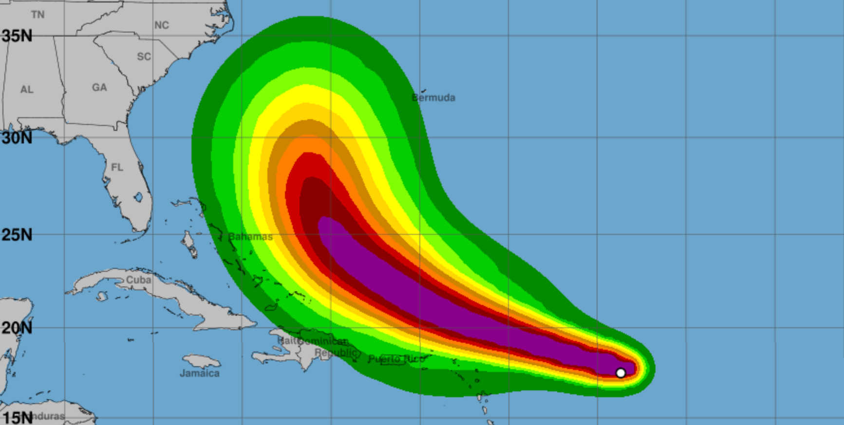
Erin's wind probabilities at 5:00 a.m. on Friday, August 15, 2025. Photo Credit: NHC.
Tropical Storm Erin is closing in on the northern Leeward Islands, with the National Hurricane Center’s (NHC) 5:00 a.m. AST advisory on Friday placing the storm about 570 miles (920 km) east of the region. The system was moving west-northwest at 17 mph (28 km/h) with maximum sustained winds of 70 mph (110 km/h) and a minimum central pressure of 997 mb.

Tropical Storm Watches remain in effect for Anguilla, Barbuda, St. Martin, St. Barthelemy, Saba, St. Eustatius, and Sint Maarten, meaning tropical-storm conditions are possible within 48 hours. The NHC is urging residents of the U.S. Virgin Islands, British Virgin Islands, and Puerto Rico to closely monitor Erin’s progress.
The Air Force Reserve Hurricane Hunters have deployed a crew to St. Croix to collect vital meteorological data on Erin, with missions beginning Thursday night. Data from these reconnaissance flights will help forecasters refine the storm’s track and intensity outlook.
Forecast Track and Strength
The NHC projects Erin will strengthen into a hurricane later today and potentially reach major hurricane status by late weekend. By Sunday, the storm is expected to be near 21.0° N, 64.8° W with winds of 115 mph, and by Monday near 25.5° N, 70.5° W with winds of 125 mph. A subtropical ridge will steer Erin west-northwest through the weekend, with a turn toward the northwest or north anticipated early next week.
European model ensembles suggest the storm’s core will remain north of the Virgin Islands and Puerto Rico, but outer rainbands may still bring gusty winds and heavy showers to the region.
Expected Hazards
Erin’s tropical-storm-force winds currently extend outward up to 90 miles (150 km) from the center. Rainfall totals of 2–4 inches, with isolated amounts up to 6 inches, are forecast from late Friday through the weekend across the northernmost Leeward Islands, the U.S. and British Virgin Islands, and southern and eastern Puerto Rico. These rains could trigger isolated flash flooding, urban flooding, and landslides.
Rainfall amounts of 1–2 inches, with isolated totals of 4 inches, are expected across central to north-central and northwestern Puerto Rico, St. Croix, and Leeward Islands from Saba south to Guadeloupe.
Swells generated by Erin will impact the northern Leeward Islands, Virgin Islands, and Puerto Rico, producing life-threatening surf and rip currents.
Local Forecasts
St. Thomas & St. John: Friday will be partly cloudy with isolated showers, highs near 93°F, and northeast winds at 10–15 mph. Conditions become cloudy tonight with showers and isolated thunderstorms. Saturday and Sunday will be cloudy, breezy, and wet, with south winds up to 25 mph and gusts reaching 35 mph on Sunday. Rain chances rise to 80–90% through Monday.
St. Croix: Expect partly cloudy skies Friday with highs around 93°F and east winds of 10–15 mph. Showers and thunderstorms will increase tonight, leading into a cloudy, wet weekend with highs near 90–91°F. North to southwest winds will range from 5–20 mph, with gusts to 25 mph.
Puerto Rico (San Juan): Variably cloudy skies with scattered showers and isolated thunderstorms Friday. Highs near 91°F with east winds at 10–15 mph. Conditions will worsen over the weekend, with 90% rain chances on Sunday and breezy south-southwest winds up to 20 mph as Erin passes north.
Marine and Coastal Conditions
Seas of 4–6 ft today will worsen over the weekend, with heights reaching 6–10 ft in the Atlantic waters and Anegada Passage. East to northeast winds will shift south as Erin passes, strengthening to 20–25 mph with higher gusts. Small Craft Advisories and possible Gale Warnings will be in effect. Swimmers are urged to avoid the water due to dangerous rip currents and high surf beginning Saturday.
Three-Day Outlook
Friday: Mostly dry to start, hazy skies, isolated showers in the afternoon.
Saturday: Outer rainbands arrive; cloudy, showers and thunderstorms, winds shifting from north to south.
Sunday: Storm passes north; heavy rain, gusty south winds, potential tropical-storm-force gusts, rainfall totals of 2–4 inches with localized 6-inch amounts possible.
Seven-Day Outlook
Rain and thunderstorms will linger into Monday, with gradual improvement Tuesday and Wednesday. Another tropical wave could bring scattered showers mid-week, though it is not expected to be as strong or organized as Erin.
Preparedness

Residents and visitors should complete hurricane preparations today, secure loose outdoor items, clear drainage areas, and stay updated through the NHC and local advisories. Boaters should remain in port starting Saturday, and beachgoers should avoid swimming in hazardous surf. Those in flood-prone areas should remain alert for potential flash flood warnings.


Advertisements


