


The National Hurricane Center (NHC) issued its 2 a.m. EDT Tropical Weather Outlook on Monday, noting Hurricane Gabrielle’s continued movement across the central subtropical Atlantic and highlighting two additional tropical disturbances under observation.

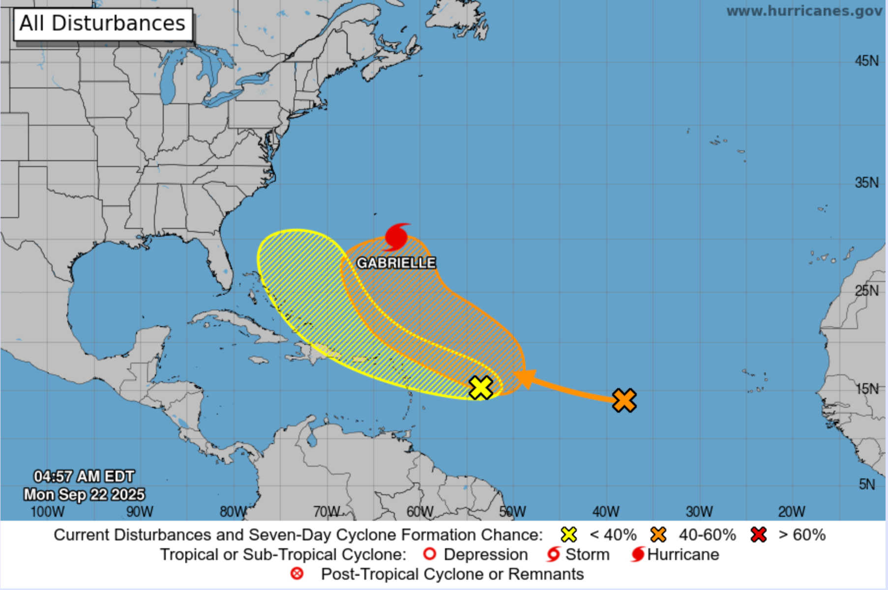
Gabrielle strengthened early Monday but remains far offshore. At 5 a.m. AST, the storm’s center was located near 30.0° N, 62.5° W, moving north-northwest at 10 mph. The hurricane’s minimum central pressure was measured at 978 mb with maximum sustained winds of about 90 mph. No coastal warnings were in effect for Puerto Rico or the U.S. Virgin Islands. Forecast guidance shows Gabrielle turning north and passing east of Bermuda later tonight.
Although Gabrielle is not expected to directly impact Puerto Rico or the USVI, the storm is generating long-period swells that are spreading toward Bermuda and the U.S. East Coast. These swells may produce dangerous surf and rip currents at exposed beaches. Local waters around Puerto Rico and the Virgin Islands may become choppy at times, but no direct hurricane effects are anticipated.
Two Tropical Waves Under Observation
The NHC is also tracking two separate tropical waves in the Atlantic:
-
Central Atlantic wave: Located west-southwest of the Cabo Verde Islands, the system is producing limited convection. Dry air should inhibit development in the near term, but conditions may improve later in the week. The NHC gave it a 10 percent chance of formation in the next 48 hours and a 60 percent chance through seven days.
-
Wave east of the Windward Islands: Moving west at 15–20 mph, this disturbance is producing disorganized showers and thunderstorms. It is expected to slow and turn northwest later in the week. Regardless of development, gusty winds and showers are forecast to affect portions of the Leeward Islands late Monday into Tuesday. Chances of formation remain low, at 10 percent through 48 hours and 30 percent through seven days.
Neither system poses an immediate hurricane threat to Puerto Rico or the Virgin Islands, but the second wave may increase rainfall and breezy conditions as it approaches.
Local Forecast for Puerto Rico and the Virgin Islands
According to the National Weather Service (NWS) in San Juan, passing tropical waves and moisture patches will shape local weather through midweek. Scattered showers and isolated thunderstorms are expected, mainly during daytime hours. Brief heavy downpours could cause ponding on roadways, and beachgoers are advised to heed any rip current advisories issued by the NWS.
Three-Day Forecast
-
Monday, Sept. 22
-
USVI: Variably cloudy in the morning with scattered showers, clearing later with isolated showers. High near 93°F, 40% chance of rain. Winds east 10–15 mph.
-
San Juan: Light morning rain followed by scattered afternoon thunderstorms, partly cloudy overnight. High 88°F, low 79°F, 65% chance of rain. Winds east 10–20 mph, shifting ESE 5–10 mph at night.
-
-
Tuesday, Sept. 23
-
USVI: Partly cloudy with scattered showers and isolated afternoon thunderstorms. High near 92°F, 50% chance of rain. Winds east 10–15 mph.
-
San Juan: Mostly sunny with isolated showers, slight afternoon increase. High 89°F, 24% chance of rain. Winds ENE 10–20 mph.
-
-
Wednesday, Sept. 24
-
USVI: Breezy and mostly cloudy with numerous showers and scattered thunderstorms likely. High near 91°F, 80% chance of rain. Winds southeast 15–20 mph.
-
Puerto Rico: Warm and humid with scattered afternoon showers and thunderstorms, locally heavy rainfall possible. High near 90°F, rain chance 50–60%. Winds east to southeast 10–15 mph.

-
Residents of Puerto Rico and the Virgin Islands should expect periods of showers, gusty winds, and thunderstorms through midweek, along with the risk of rip currents along local beaches.


Advertisements


