


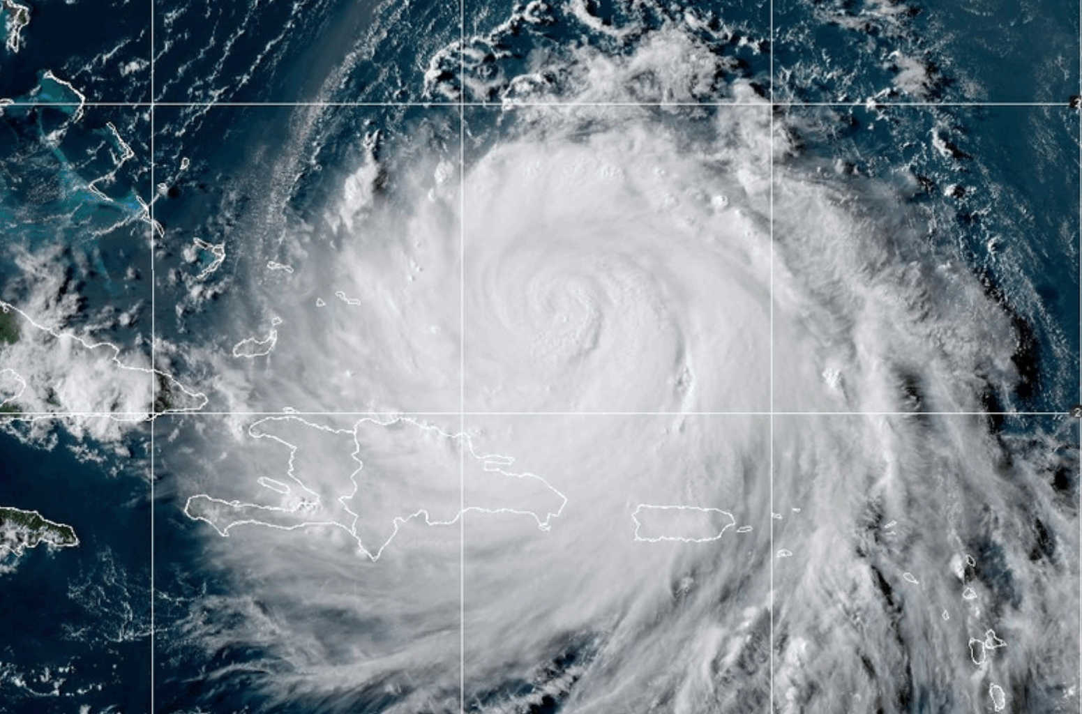
As Hurricane Erin continues to move farther away from the region, authorities say the storm is expected to intensify again and expand in size, even as indirect impacts remain in effect across the U.S. Virgin Islands and Puerto Rico through at least Monday.

As of 5:00 p.m. AST on Sunday, Erin’s center was positioned approximately 275 miles northwest of San Juan, Puerto Rico, tracking west-northwest at 13 mph. Although no longer directly affecting the area, the storm’s outer bands are still delivering heavy rainfall, dangerous marine conditions, and life-threatening surf along coastal areas.
Life-Threatening Surf and Rip Currents
Large breaking waves ranging from 7 to 13 feet are producing hazardous rip currents along north, northwest, and east-facing beaches of Puerto Rico, Vieques, Culebra, and the U.S. Virgin Islands. The National Weather Service has issued High Surf Advisories through 6:00 a.m. Monday and a High Rip Current Risk through 6:00 p.m. Monday.
Dangerous Seas for Small Craft
Rough marine conditions continue, particularly across the Atlantic and Mona Passage, where seas are reaching 7 to 10 feet. Small Craft Advisories remain in effect across the offshore Caribbean waters, the Anegada Passage, and the eastern waters of Puerto Rico through Monday morning. Additional advisories are in place for the Atlantic Waters, northwestern coastal areas of Puerto Rico, and the Mona Passage through Monday afternoon.
Flood Watch Remains in Effect
Showers and thunderstorms are expected to persist into early next week, with additional rainfall accumulations of 2 to 4 inches forecast across all islands through Monday. A Flood Watch remains in effect through Monday evening, as saturated grounds and elevated streamflows raise the potential for flooding.
Highest Rainfall Totals So Far
According to preliminary radar estimates, Erin's outer bands have produced intense rainfall since Friday night. The highest totals reported were 6.28 inches in Cayey, Puerto Rico, and 7.32 inches in St. John, U.S. Virgin Islands. The storm has brought heavy showers, frequent lightning, and gusty winds. River levels remain high, and more rain is anticipated within the next 24 hours as tropical moisture lingers over the region while Erin continues its northward path.

The National Weather Service in San Juan will issue a final briefing on Hurricane Erin at 11:00 a.m. AST on Monday, August 18, 2025, unless conditions warrant an earlier update.


Advertisements