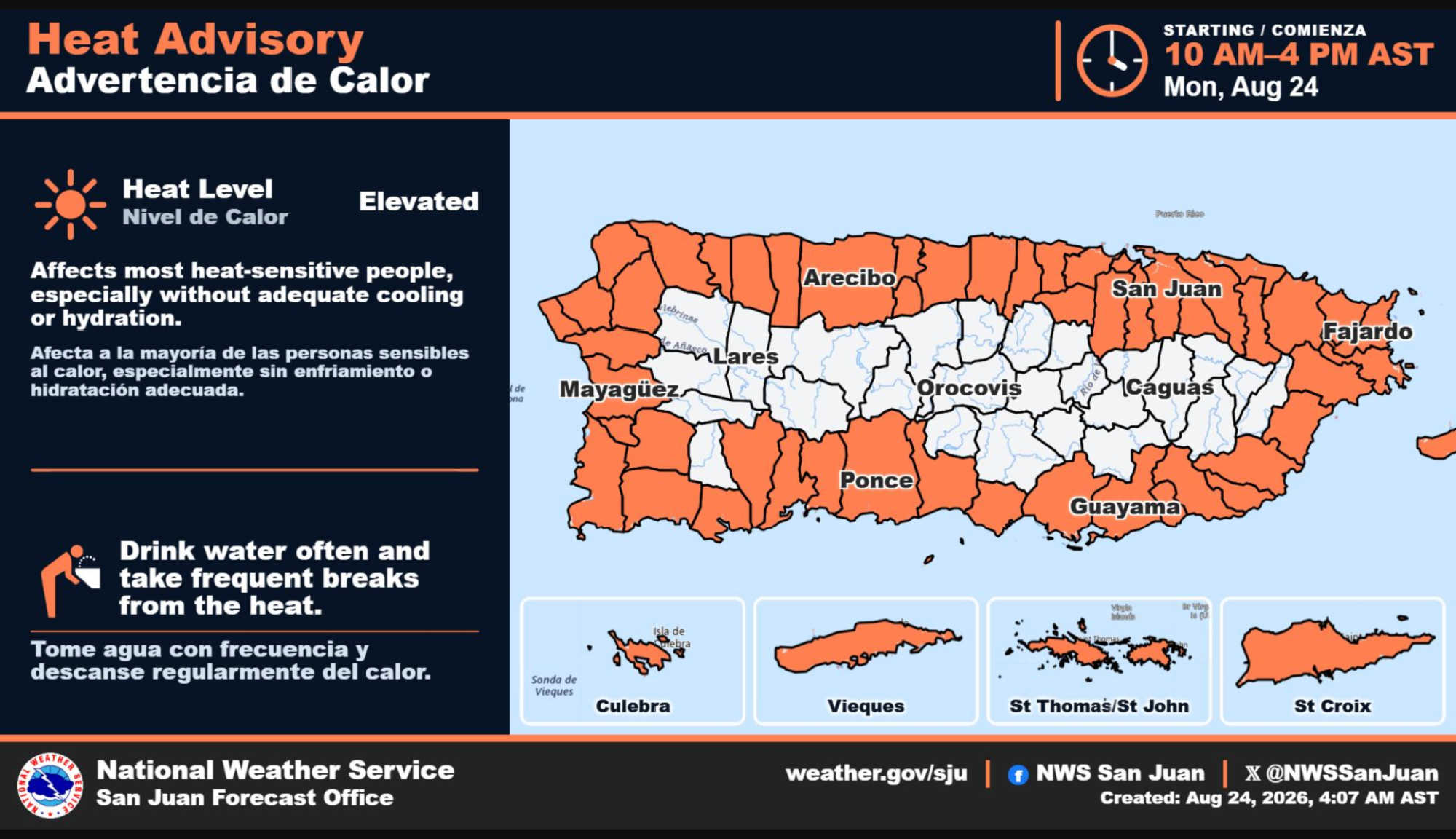
The U.S. Virgin Islands will begin the week under another Heat Advisory Monday before a more defined tropical wave increases shower activity Tuesday, which National Weather Service forecasters in San Juan currently expect to offer the best chance for more widespread rainfall during the first half of the week. Saharan dust is then forecast to spread into the region Wednesday afternoon into Thursday, while warmer-than-normal temperatures are expected to persist through the weekend.

The Heat Advisory covers St. Croix, St. Thomas, St. John and adjacent islands from 10 a.m. until 4 p.m. Monday. NWS said hot temperatures combined with high humidity could cause heat-related illnesses, particularly among people without adequate cooling or hydration. Increasing sunshine as a slightly drier air mass moves into the area Monday will help drive temperatures and heat indices higher, especially across coastal and urban areas.
Monday itself should be comparatively quieter in terms of rainfall. Moisture left behind by the weak tropical wave that crossed the region over the weekend will continue moving away, while a somewhat drier air mass just east of the Virgin Islands filters across the territory. Passing showers remain possible, but NWS expects more limited activity overall before moisture begins increasing again late Monday night.
For St. Croix, NWS forecasts scattered showers mainly between 9 a.m. and noon Monday, followed by sunshine and a high near 90 degrees. The heat index could reach 102 degrees, with a 30 percent chance of rain. St. Thomas is forecast to reach about 85 degrees, with scattered morning showers, isolated showers later in the day and a 40 percent chance of precipitation.

The weather becomes more unsettled Tuesday as a second and better-defined tropical wave moves across the forecast area. NWS said atmospheric moisture should rise substantially, making Tuesday the best day in the current forecast for more widespread showers. Although heavier pockets of rain are possible across the region, forecasters do not currently expect the rainfall to be sufficient to significantly improve ongoing drought conditions.
On St. Croix, scattered showers are forecast Tuesday with a 40 percent chance of rain, a high near 90 degrees and heat-index values potentially reaching 104 degrees. St. Thomas also carries a 40 percent chance of scattered showers, with east-southeasterly winds of 16 to 18 mph and gusts reaching 25 mph. The broader NWS forecast indicates showers could become more numerous across eastern portions of the region as the wave passes.
By Wednesday, the atmosphere should return to a more typical summertime pattern as winds shift back toward the east. At the same time, moderate concentrations of Saharan dust are forecast to begin filtering into the islands Wednesday afternoon and continue into Thursday, bringing hazier skies and helping suppress widespread shower development. St. Croix has a 20 percent chance of isolated showers Wednesday, while a similar 20 percent chance is forecast around St. Thomas during the day.
Thursday and Friday are expected to trend drier than normal as high pressure over the central Atlantic and a mid-level ridge promote more stable conditions. Brief, fast-moving trade-wind showers will still be possible, and local forecasts show some differences across the territory: St. Croix currently carries a 50 percent chance of scattered showers Friday afternoon, while the St. Thomas point forecast remains mostly sunny. Forecasters caution that temperatures will remain warmer than normal, and conditions could support additional heat advisories or warnings toward the end of the week.
Another tropical wave may approach from Friday night into Saturday. Current guidance keeps most of that wave's moisture over the Caribbean Sea, with only its northern edge reaching the region, but NWS emphasized that uncertainty remains and residents should continue monitoring forecast updates. Drier and more stable air is currently projected to return quickly after the wave passes, limiting rainfall chances heading into early next week.
Marine conditions will also become somewhat rougher as the week progresses. Seas are generally forecast at 3 to 5 feet Monday, while Tuesday's tropical wave could produce increased showers and thunderstorms over local waters. Winds are expected to strengthen by midweek, with seas building to 3 to 5 feet and occasionally 6 feet across offshore waters and passages. The rip-current risk remains low early in the week but is expected to increase to moderate by Thursday, particularly along northern and eastern-facing beaches.
Meanwhile, the National Hurricane Center is monitoring two areas in the Atlantic with a 50 percent chance of tropical cyclone formation during the next seven days. The first, designated AL95, is a low-pressure system several hundred miles southeast of Bermuda. NHC said it could become a short-lived tropical depression or tropical storm during the next couple of days as it moves northward and north-northeastward, eventually passing well northeast of Bermuda. Its formation probability is 50 percent through both 48 hours and seven days.
The second system is much farther east. A tropical wave is expected to emerge from the west coast of Africa Monday, with low pressure potentially developing along it early this week. Environmental conditions are forecast to be only marginally favorable, but NHC said a tropical depression could form during the middle to latter part of the week as the system moves generally westward at 15 to 20 mph across the eastern and central tropical Atlantic. Its development chance is 10 percent through 48 hours and 50 percent through seven days.
The latest outlook marks an increase in development probabilities from the NHC outlook over the weekend. The central subtropical system, which carried a 20 percent seven-day development chance in Saturday's outlook, is now at 50 percent, while the tropical wave emerging from Africa has risen from 30 percent to 50 percent. A third area that had been monitored near Portugal is no longer included in Monday morning's Atlantic outlook.

Neither of the two systems currently highlighted by the National Hurricane Center is near the Virgin Islands. The Tuesday tropical wave discussed by NWS San Juan is already approaching the northeastern Caribbean and is separate from the newly emerging wave off Africa. For the territory, the more immediate weather concerns are Monday's hazardous heat, increased showers with Tuesday's wave, Saharan dust and continued above-normal warmth later in the week.