




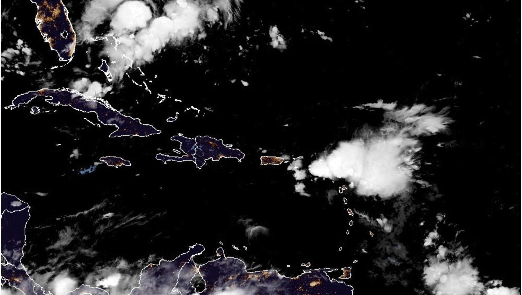
The remnants of Tropical Storm Dolly are beginning to affect the U.S. Virgin Islands early Sunday, with moisture from the strong tropical wave already producing rainfall and lightning near St. Croix and forecasters expecting showers, thunderstorms and gusty winds to become more widespread across the territory through today and into Monday.

The National Weather Service in San Juan said in its 3:06 a.m. Sunday forecast discussion that moisture associated with Dolly’s remnants will continue increasing from east to west throughout the day, with showers and thunderstorms becoming more frequent first across the Virgin Islands before spreading into eastern Puerto Rico and then farther west. Atmospheric moisture levels are expected to rise well above normal, supporting an unstable weather pattern.
The primary threats for the USVI are urban and poor-drainage flooding, lightning and gusty winds. NWS currently places the territory under a limited flooding risk today and Monday. While the chance of flash flooding is lower, forecasters said isolated flash flooding cannot be ruled out.
Periods of squally weather could produce moderate to locally heavy rainfall. NWS said the rainfall should provide some relief from the territory’s ongoing drought, but is not expected to end it. Lingering tropical moisture could continue producing showers Tuesday before hotter conditions begin returning.

St. Croix: Rain and Thunderstorms Increasing This Morning
St. Croix is expected to be among the first areas of the territory to feel the wave’s effects. NWS said rainfall and lightning activity had already begun developing near the island early Sunday morning.
The latest forecast calls for showers and possible thunderstorms on St. Croix today, with an 80 percent chance of precipitation. Winds are expected to shift from the northeast toward the south-southeast as the wave moves through, with gusts potentially reaching around 25 mph.
Rain and thunderstorms remain possible tonight and into Monday as tropical moisture stays across the region.
St. Thomas and St. John: 90 Percent Rain Chance, Gusts Into the 30s
The latest NWS forecast for St. Thomas and St. John calls for a 90 percent chance of rain today, with cloudy conditions, showers and isolated thunderstorms.
Winds are expected to shift from the east at 15 to 20 mph to the southeast at 15 to 25 mph during the afternoon. Sunday night remains particularly unsettled, with an 80 percent chance of rain and southeast winds of 15 to 25 mph, with gusts reaching 35 mph.
A more location-specific forecast for Charlotte Amalie and Cyril E. King Airport similarly calls for showers and thunderstorms today, with winds increasing during the afternoon and gusting close to 30 mph. Sunday night could bring additional thunderstorms and gusts into the mid-30s.
The Weather Channel also forecasts thunderstorms across St. Thomas today and locally heavy rainfall tonight, reinforcing the expectation of an unsettled Sunday and Sunday night.
Dolly Unlikely to Regenerate
While the weather associated with Dolly is intensifying across the northeastern Caribbean, the National Hurricane Center continues to indicate that redevelopment into a tropical cyclone is unlikely.
At 2 a.m. Sunday, the NHC described Dolly’s remnants as a strong tropical wave producing showers and thunderstorms just east of the northern Leeward Islands. Satellite and surface observations showed no closed circulation.
The system was moving west to west-northwest at approximately 25 mph, with a near-zero chance of tropical cyclone formation over the next 48 hours and a 10 percent chance through seven days. The NHC nevertheless warned that the wave could produce locally heavy rainfall and gusty winds across the Leeward Islands, Virgin Islands and Puerto Rico over the next couple of days.
Hazardous Seas and High Rip-Current Risk
Marine and coastal conditions are also expected to deteriorate as the wave crosses the area.
NWS San Juan said squally weather, strong gusts and hazardous seas are expected across most local waters. Small Craft Advisory conditions are expected mainly across the eastern coastal waters of Puerto Rico and the USVI, Atlantic waters and the Anegada Passage through early Monday.
The remnants are also generating stronger winds and easterly swells, creating a high risk of rip currents across the U.S. Virgin Islands. NWS is urging beachgoers and inexperienced swimmers to stay out of the water along exposed coastlines because of potentially life-threatening rip currents and rough surf. Thunderstorms could also bring cloud-to-ground lightning and sudden strong wind gusts near beaches and coastal waters.
The Rip Current Statement affecting St. Croix, St. Thomas and St. John remains in effect through 6 p.m.
Monday Remains Unsettled; Heat Returns Afterward
Dolly’s remnants should continue influencing the territory Monday as deep tropical moisture remains over the region. NWS expects the same general hazards — showers, thunderstorms, localized flooding and gusty winds — to persist before the main axis of the wave moves farther west.
St. Thomas and St. John currently carry a 50 percent chance of showers Monday, with isolated thunderstorms and gusts as high as 25 mph.
By Tuesday, lingering moisture could still support showers, but NWS expects hotter conditions to return as the tropical wave departs. Forecasters are already highlighting the possibility of renewed heat-related impacts beginning Tuesday.

The National Weather Service is advising residents to remain alert today as conditions can change quickly within passing squalls, particularly where thunderstorms produce locally heavy rainfall and strong wind gusts.