

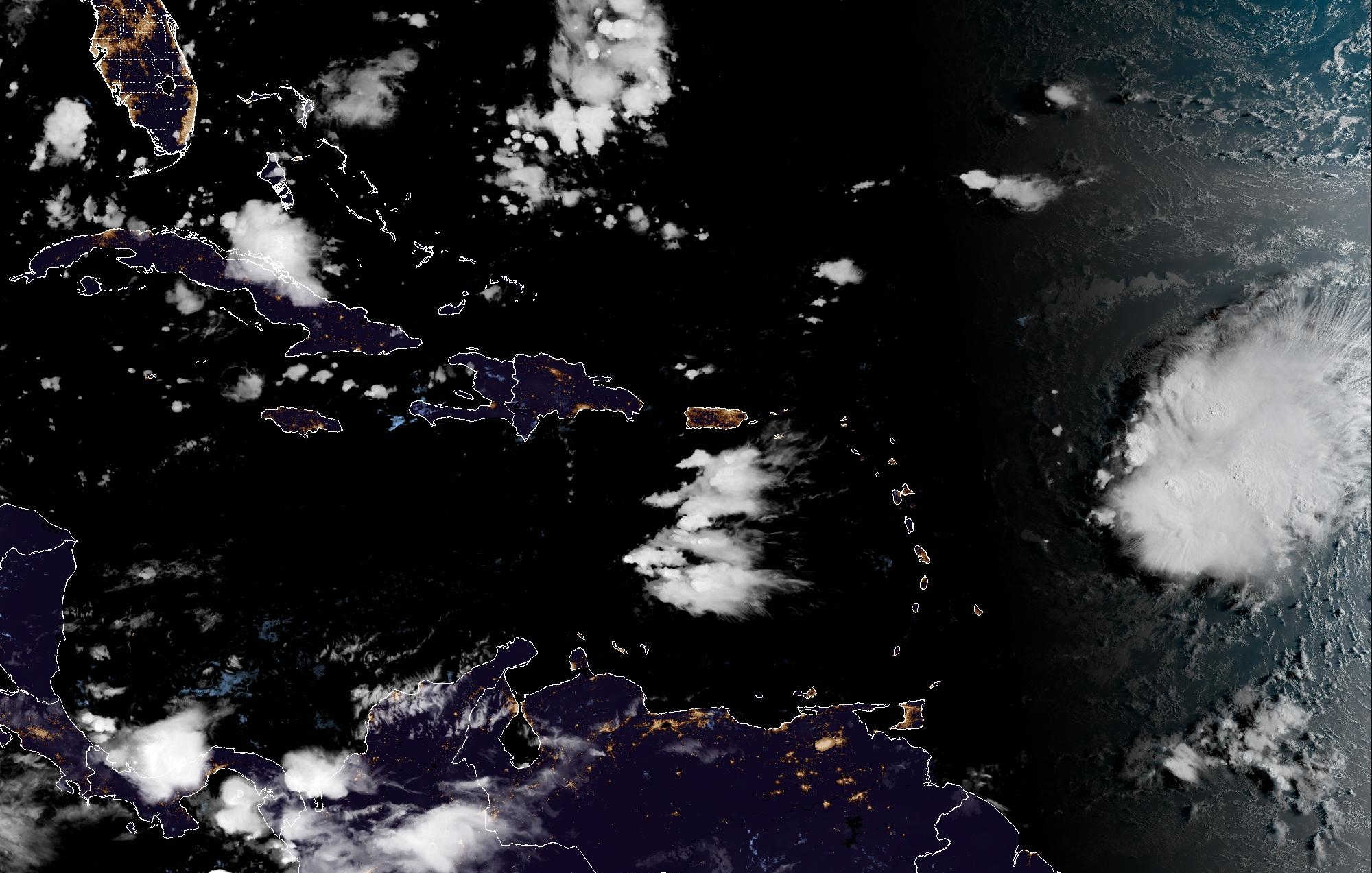
Tropical Storm Dolly has dissipated into a tropical wave, but its remnants are expected to begin affecting the U.S. Virgin Islands late Saturday into Sunday, bringing a wetter and windier pattern with periods of moderate to locally heavy rain, thunderstorms and gusty winds through Monday.

The National Weather Service in San Juan says rainfall totals of 1 to 3 inches are generally possible across Puerto Rico and the Virgin Islands as Dolly’s moisture moves through, with the main hazards including urban and poor-drainage flooding, lightning and strong wind gusts. Isolated flash flooding cannot be ruled out, although forecasters currently consider that risk lower.
The latest National Hurricane Center outlook early Saturday placed the remnants of Dolly several hundred miles east of the Leeward Islands, moving west to west-northwest at approximately 25 mph. Redevelopment is considered unlikely, with a near-zero chance of formation over the next 48 hours and a 10 percent chance over seven days. The NHC nevertheless cautioned that the wave could bring locally heavy rainfall and gusty winds to the Leeward Islands, Virgin Islands and Puerto Rico over the next several days.
That represents the expected evolution of a system VIC first reported on Thursday, when Dolly had just become a tropical storm with 40 mph winds but was already forecast to weaken before reaching the northeastern Caribbean. The weakening has occurred, but the moisture and weather associated with the former storm remain relevant to the territory.

Saturday: Heat First, Then Weather Begins to Change
Before Dolly’s moisture arrives in earnest, Saturday is expected to remain relatively dry and hot across much of the territory.
A Heat Advisory is in effect for the USVI from 10 a.m. to 5 p.m. Saturday. On St. Croix, the NWS forecast calls for mostly sunny conditions with a high near 91 degrees and heat-index values reaching approximately 105. St. Thomas and St. John are expected to reach around 94 degrees, with breezy east winds and only isolated showers during the daytime.
Conditions begin changing Saturday night as moisture associated with Dolly’s remnants reaches the region. NWS San Juan expects the frequency of showers and thunderstorms to increase across the Virgin Islands overnight and into Sunday morning.
St. Croix: 70 Percent Rain Chance Sunday
The current NWS point forecast for St. Croix calls for a 70 percent chance of rain Sunday, with showers likely and thunderstorms possible throughout portions of the day.
Forecasters currently expect three-quarters of an inch to one inch of rainfall during the daytime Sunday alone around the Christiansted/Henry E. Rohlsen Airport area. The high is expected to fall to around 86 degrees as cloud cover and rainfall provide temporary relief from the heat. Winds are forecast to shift from east-northeast at 9 to 14 mph to southeast at 16 to 21 mph during the afternoon.
Scattered showers and thunderstorms remain possible Sunday night, followed by a 50 percent chance of showers Monday, with thunderstorms possible after noon. Scattered showers remain in the St. Croix forecast Tuesday as lingering tropical moisture stays over the region.
St. Thomas and St. John: Windier Sunday
St. Thomas and St. John are also forecast to see a 70 percent chance of rain Sunday, with numerous showers and isolated thunderstorms.
The NWS expects northeast winds of 15 to 20 mph Sunday morning to strengthen and shift southeast during the afternoon at 20 to 30 mph. Sunday night could bring gusts as high as 35 mph, along with scattered showers and isolated thunderstorms.
Monday remains unsettled, with a 50 percent chance of showers and isolated thunderstorms across St. Thomas and St. John. Rain chances remain around 50 percent Tuesday before conditions begin becoming more variable later in the week.
Rain Could Help Drought, But Won't End It
The incoming rainfall is expected to provide some relief from the territory’s ongoing drought, but NWS San Juan says it will not be enough to erase the severe to extreme drought conditions affecting the region.
Forecasters emphasized that this is not currently expected to be a widespread, prolonged rainfall event. Instead, squalls moving through the islands could produce periods of moderate to locally heavy rain, meaning rainfall totals could vary considerably from one location to another.
Areas with poor drainage or drainage systems clogged by dry vegetation could be particularly susceptible to localized flooding.
Rougher Seas and Higher Rip-Current Risk
Marine conditions are also expected to deteriorate as the remnants approach.
NWS San Juan expects squally weather, strong gusts and hazardous seas across much of the regional waters, with Small Craft Advisory conditions developing mainly across Atlantic waters and the Anegada Passage Sunday and Monday.
Waters around St. John, Vieques and Culebra could see seas of 4 to 6 feet, occasionally reaching 8 feet Sunday, increasing to 5 to 7 feet and occasionally 9 feet Sunday night. Winds in those waters could reach 20 to 25 knots with gusts approaching 30 knots.
The risk of dangerous rip currents along north- and east-facing beaches of the U.S. Virgin Islands is expected to rise from moderate Saturday to high Sunday and Monday as swells associated with Dolly’s remnants reach the area. NWS San Juan also warns of lightning and gusty winds around beaches and coastal waters during the unsettled period.

By Tuesday, lingering moisture could continue producing showers before conditions become somewhat drier later in the week. Hazardous heat is expected to return around midweek after the temporary relief provided by increased clouds and rainfall Sunday and Monday.