




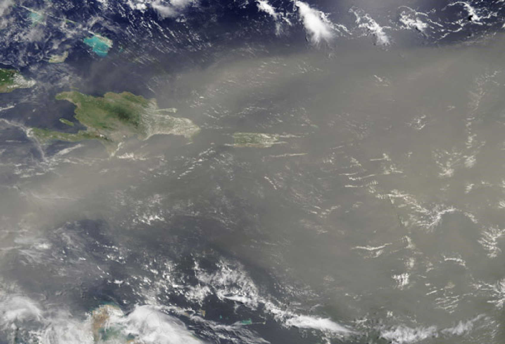
A dense plume of Saharan dust is expected to move across the U.S. Virgin Islands beginning Thursday night, following two tropical waves that are forecast to increase shower activity across the territory Wednesday and Thursday, according to the National Weather Service in San Juan.

In its 3:29 a.m. forecast discussion Tuesday, NWS said moderate concentrations of Saharan dust will move through the region intermittently before a dense Saharan Air Layer carrying high dust concentrations arrives Thursday night. Forecasters expect the plume to produce widespread haze, reduced visibility and deteriorating air quality as substantially drier air spreads across the region.
The dust will follow a wetter period expected during the middle of the week. Tropical waves moving across the islands Wednesday and Thursday are forecast to increase the potential for showers, with a limited flooding threat in some areas. The unsettled weather will develop while brisk east to east-southeast winds continue across the region.
For St. Thomas and St. John, the latest NWS forecast calls for scattered showers Wednesday and Thursday, with winds around 20 to 24 mph and gusts approaching 30 mph. Widespread haze is forecast to begin Thursday night and persist Friday and Saturday. Daytime temperatures are expected to remain around 89 to 90 degrees.

St. Croix is also expected to see increased rainfall before the dusty air arrives. The latest forecast for the Christiansted and Henry E. Rohlsen Airport area shows increased shower chances Wednesday, scattered showers Thursday and widespread haze Friday. Temperatures are forecast to remain near 90 degrees.
Before those midweek changes arrive, the territory faces another period of excessive heat Tuesday. A Heat Advisory is in effect throughout the U.S. Virgin Islands from 10 a.m. until 5 p.m., with NWS advising residents and visitors to limit strenuous outdoor activity, remain hydrated and seek cooler environments when possible.
The arrival of the dense Saharan Air Layer late Thursday is expected to sharply reduce atmospheric moisture. NWS said the resulting dry air and high dust concentrations will lead to hazy conditions and reduced visibility while suppressing much of the rainfall by Friday. People who are particularly sensitive to poor air quality should follow any medical recommendations and monitor subsequent forecasts as the plume approaches.
Saharan Air Layers form when large volumes of dry, dusty air move westward from the Sahara Desert across the tropical Atlantic. NOAA says the dust can travel thousands of miles and routinely reaches the Caribbean, particularly during the late spring, summer and early fall.

Marine and beach conditions are also expected to become increasingly choppy as easterly winds strengthen. NWS has identified a moderate risk of dangerous rip currents along northern and eastern-facing beaches in portions of the local islands, and beachgoers are being urged to remain cautious.