


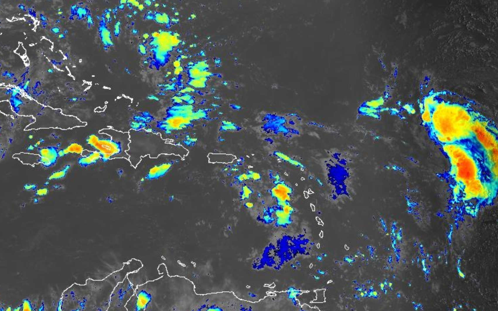
Satellite imagery from Sept. 24, 2025 shows a tropical wave east of the Virgin Islands producing widespread showers and thunderstorms, with additional systems visible in the Atlantic. Photo Credit: NOAA.
The National Weather Service (NWS) in San Juan issued a Hazardous Weather Outlook early Wednesday morning, warning that a tropical wave moving across the eastern Caribbean will bring heavy rain, thunderstorms, gusty winds, and dangerous marine conditions to the U.S. Virgin Islands through today and into Friday.

According to the 5:06 a.m. advisory, life-threatening flash flooding is possible across all three islands, with the potential for water to enter structures and cut off neighborhoods. Flooding in urban areas, roads, small streams, and washes is also expected, with soils already saturated from recent rainfall.
The NWS cautioned that isolated to scattered thunderstorms could develop across the territory today and tonight, producing frequent lightning. Residents are urged to stop outdoor activities and seek shelter if storms occur. Breezy to windy conditions are forecast, with sustained winds of 23–33 knots (26–38 mph) most likely across the Anegada Passage and Atlantic waters. Loose outdoor items may be damaged or blown around.
Hazardous marine conditions are expected, especially across Atlantic waters, where seas may reach seven feet or higher. Small craft operators are advised to exercise extreme caution. Life-threatening rip currents remain possible along all coastal areas, with the highest risk near piers, jetties, and channels.
Looking ahead, the NWS said the risk of excessive rainfall will remain elevated through at least Friday as the tropical wave moves west-northwest across the area. Hazardous marine conditions will persist, with a moderate rip current risk most days. Dangerous heat concerns are forecast to return by the weekend.
National Hurricane Center Advisory
The National Hurricane Center (NHC) reported at 2:00 a.m. that the tropical wave, identified as Invest 94L, is producing a broad area of disorganized showers, thunderstorms, and gusty winds across much of the Windward and Leeward Islands.
The wave is moving west-northwest at 15 to 20 mph, spreading heavy rainfall and gusty winds into Puerto Rico and the Virgin Islands today, and across the Dominican Republic tonight. By late week, the disturbance is expected to slow and turn northwestward as it reaches the southwestern Atlantic, where environmental conditions will be more favorable for development.
The NHC said a tropical depression is likely to form when the system reaches the vicinity of the Bahamas. Interests in Puerto Rico, the Virgin Islands, the Dominican Republic, the Turks and Caicos Islands, and the Bahamas should closely monitor the system’s progress.
-
Formation chance through 48 hours: low, 30%
-
Formation chance through 7 days: high, 80%

Spotter activation has been encouraged by the NWS, which asked residents to report flooding, winds, waves, and rip currents to the San Juan office. Officials reminded the public that conditions may deteriorate rapidly and urged residents to avoid flood-prone areas, exercise caution along coastal waters, and remain alert to updates from both the NWS and NHC.


Advertisements


