


Street signage on the East End of St. Croix By. ERNICE GILBERT/ VI CONSORTIUM
ST. CROIX — Lieutenant Governor Tregenza Roach and his team at the Office of the Lieutenant Governor (OLG) on Wednesday held a press conference to announce that the street-naming initiative, which was recently completed on St. Thomas, had started on St. Croix, and the office — beginning this evening — would host the first of two town hall meetings where the community will get to give input, especially in naming the streets.

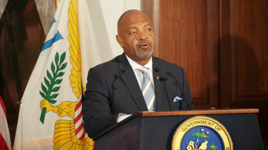
Mr. Roach, who acknowledged that the initiative started in earnest several years ago but had laid dormant with virtually zero activity, has made the street-naming work one of his signature efforts. "...We believe that this is too important an initiative to let lie," he said during the press conference, held at Government House on St. Croix.
"Simply put, through the street-naming initiative we hope to create an urban grid starting with all of our towns — Frederiksted, Christiansted, Cruz Bay and Charlotte Amalie — and then later to spread out to the entire territory," the lieutenant governor added.
(Below, Lieutenant Governor Roach at the press conference on St. Croix. Credit: Ernice Gilbert, VIC)
According to Chris George, administrator of the Geographic Information System (GIS) at the Office of the Lieutenant Governor, about 60 percent of St. Croix streets had already been named. For the remaining 40 percent, however, the OLG said it's seeking the community's input and was ready to provide answers to questions during the town halls scheduled for today in Frederiksted at the American Legion Hall, beginning at 6:00 p.m., and on February 26 at the University of the Virgin Islands, also at 6:00 p.m. (For more information call 340-693-6191, or visit their website: ltg.gov.vi/streetaddressinginitiative.)
"The street addressing is the single most critical, important project for modern infrastructure for the Virgin Islands," Mr. George said, quoting part of what he said was Governor Albert Bryan's State of the Territory Address in January.
The project was created by the OLG to establish three main goals, according to Mr. George: to create an addressing system for the territory that provides a clear logical and navigable system of street addresses territory-wide. The second goal is to document and record the addresses throughout the USVI and make it available in a master repository for easy access. The third goal sees the data being made available to both private and public entities through partnerships. This signals a deeper access level than the basic, search-and-find functionality of the OLG's second goal available to the public. Mr. George said the partnerships with select private and public entities will allow for utilization of the data for essential services such as postal and emergencies.
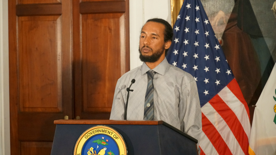
Below, Geographic Information System Administrator Chris George speaks during the Wednesday press conference. Credit: Ernice Gilbert, VIC)
The initiative, underway on St. Croix, saw Frederiksted being finalized last week, with work commencing in Christiansted this week, Mr. George said. The effort started in October 2019 in St. Thomas, and was completed in the territory's capital on Dec. 20. The St. Croix effort was launched on Jan. 6 and the OLG is estimating a completion date of February 20. Thereafter, the initiative will head to St. John on February 24 with an estimated completion date of April 15.
Partnerships
Along with a number of local departments and agencies — the V.I.P.D., VITEMA and the Dept. of Health among them — the OGL is also partnering with the U.S. Postal Service. Mr. George said once the initiative is completed, the Postal Service will then move to insert the information into its database for use.
The OGL has also partnered with the major U.S. tech firms such as Google and Apple — the two firms with the most dominant maps apps, for integration. "The Office of the Lieutenant Governor, GIS Division, is an official Google partner. We have direct communication with Apple Maps; we are an Open Street contributor," Mr. George said. "We're a contributor on Esri Community Maps and TomTom so we have a good relationship with most global mapping engines, which allows us to then facilitate information back and forth."
The cost for the territory-wide street-naming initiative is about $5.4 million, Mr. George told the Consortium. He said most of the funds are being expended through the creation of signage. Previously, the OGL had sourced a mainland firm for the work, but has since been utilizing more local printing companies, keeping the circulation of dollars in the territory.


