

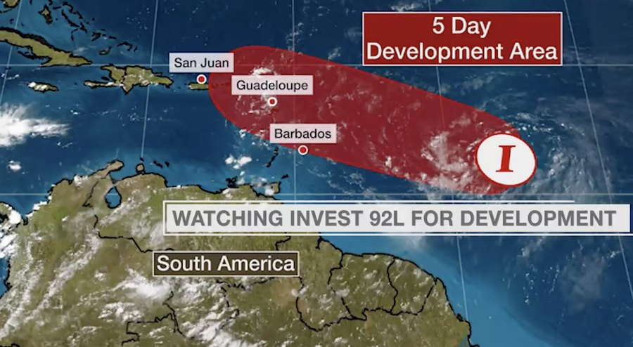
A weather system that is headed toward the Leeward Islands, including the USVI and Puerto Rico, has become better organized overnight and is expected to become a depression or tropical storm "in the next couple of days," the National Hurricane Center said in its 2:00 a.m. Tuesday forecast of the system.

N.H.C. said interests in the USVI and Puerto Rico should monitor the system, as it is expected to start affecting the U.S. territories Wednesday night and Thursday.
According to N.H.C., shower activity associated with the system, which was located 750 miles east of the Windward Islands at 2:00 a.m., is gradually increasing in organization. However, recent satellite-derived wind data indicate that the circulation remains broad and elongated, and the low does not yet have a well-defined center of circulation.
Even so, environmental conditions are expected to become somewhat more conducive for development, and a tropical depression or tropical storm is likely to form during the next couple of days while the system moves west-northwestward at 15 to 20 mph and approaches the Leeward Islands, N.H.C. said.

"Regardless of development, locally heavy rains and gusty winds are likely across portions of the Leeward Islands on Wednesday and will spread westward to the Virgin Islands and Puerto Rico Wednesday night and Thursday," N.H.C. said. "Interests on these islands should continue to monitor the progress of this system, and tropical storm watches or warnings could be required for portions of the area later today."