

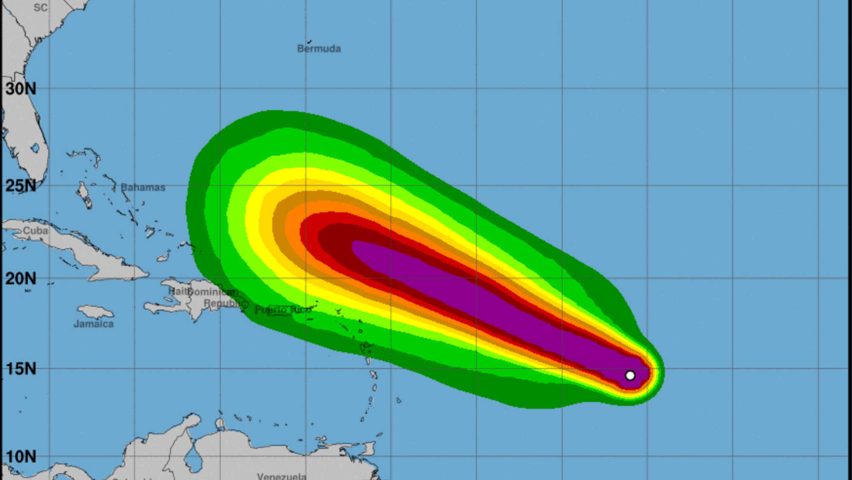
The U.S. Virgin Islands and Puerto Rico are on high alert as Hurricane Lee, now located at 14.9 N latitude and 46.4 W longitude, is forecast to rapidly intensify into a major hurricane. According to the latest update by the National Hurricane Center, the storm will pass several hundred miles north of the islands between late Sunday and Monday.

Coastal and marine conditions in the U.S. Virgin Islands are expected to deteriorate as early as this Saturday and persist through next week. Swells generated by Lee are predicted to build sea levels between 8 and 12 feet during the weekend. As the hurricane intensifies and approaches the northeastern Caribbean, these swells are likely to cause large breaking waves along the north and east-facing beaches of the U.S. Virgin Islands, leading to high surf and life-threatening rip currents.
Although the rainfall and wind impacts are still uncertain, residents are urged to stay vigilant and prepare for any sudden changes in weather conditions.
The impacts of Hurricane Lee extend beyond the U.S. Virgin Islands. The north and east-facing beaches of Puerto Rico are also expected to experience high surf and dangerous rip currents. Residents and tourists in both territories should exercise extreme caution while venturing near the coastline.
The situation remains fluid, and there is still a significant amount of uncertainty regarding the storm's impact on rainfall and winds. The next update from NWS San Juan is scheduled for Thursday, September 7th, at 6 p.m., or sooner if conditions warrant.

In its advisory number 6, the National Hurricane Center in Miami, FL, confirmed that Lee has strengthened into a hurricane with maximum sustained winds of 75 mph and is likely to evolve into an "extremely dangerous major hurricane" by early Saturday. Currently, there are no coastal watches or warnings in effect, but interests in the northern Leeward Islands are advised to monitor the progress of this system.