

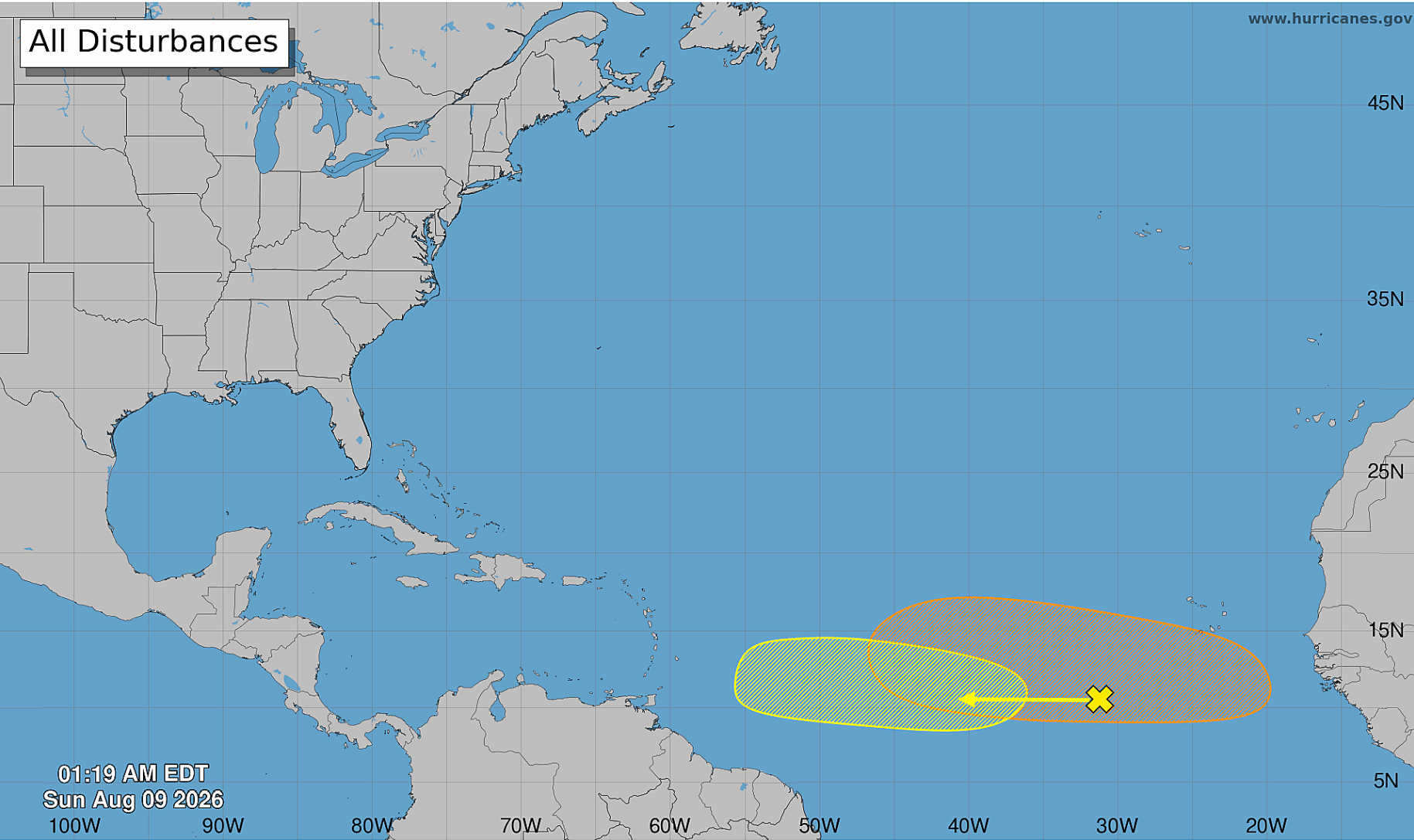
The National Hurricane Center is monitoring two tropical waves moving westward across the Atlantic, including one expected to emerge from Africa early this week that now carries a 40 percent chance of development over the next seven days.

A second disturbance farther west, several hundred miles southwest of the Cabo Verde Islands, has a 20 percent chance of developing during the same period as it moves across the central tropical Atlantic toward the Lesser Antilles.
Neither system is expected to develop during the next 48 hours, with the NHC placing formation chances for both at near zero percent as of its 2 a.m. Sunday Tropical Weather Outlook.
There were no active tropical cyclones in the Atlantic at the time of the outlook.

Eastern Atlantic Wave Has 40% Seven-Day Chance
The system with the higher development probability is a tropical wave expected to move off the west coast of Africa early this week.
Environmental conditions are forecast to become favorable for gradual organization after the wave emerges over the Atlantic.
The NHC said a tropical depression could form during the latter half of the week while the disturbance moves westward across the eastern and central tropical Atlantic.
Its formation probability remains near zero percent through 48 hours but rises to a medium chance of 40 percent through seven days.
Second Wave Has 20 Percent Chance Before Approaching Lesser Antilles
Farther west, a broad area of showers and thunderstorms associated with another tropical wave is located several hundred miles southwest of the Cabo Verde Islands.
Some gradual development is possible during the early to middle part of the week as the disturbance continues westward across the central tropical Atlantic.
The environment is expected to become less supportive of development later in the week, however, as the system approaches the Lesser Antilles. Upper-level winds are forecast to become less conducive for organization during that period.
The NHC gives the disturbance a near-zero chance of formation during the next 48 hours and a 20 percent chance during the next seven days.

Both systems remain disturbances and had not developed into tropical depressions or named storms as of the Sunday morning outlook.