


0
The National Hurricane Center has issued a tropical storm warning for the U.S. Virgin Islands and Puerto Rico, as potential cyclone number 6 is projected to develop into a tropical storm today, and is expected to impact the USVI later today and tonight.

A tropical storm warning means that tropical storm conditions are expected somewhere within the warning area within 36 hours.
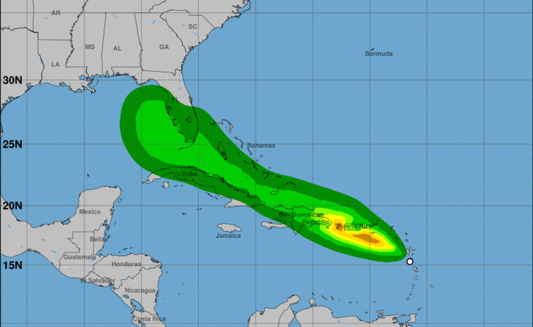
According to the N.H.C.'s 5:00 a.m. Tuesday forecast, the disturbance was centered near latitude 15.7 North, longitude 62.2 West. The system is moving toward the west-northwest near 17 mph (28 km/h) and this general motion is expected to continue during the next few days. On the forecast track, the disturbance is expected to pass near or over the U.S. Virgin Islands and Puerto Rico late today and tonight, and be near or over Hispaniola on Wednesday.
Maximum sustained winds remain near 35 mph (55 km/h) with higher gusts. Gradual strengthening is forecast during the next day or so and the disturbance is expected to become a tropical storm later this morning. Some weakening is likely while the system interacts with Hispaniola on Wednesday.
Formation chance is high at 90 percent in both the 48-hour and five-day categories, according to N.H.C.
Key Message
- The system is forecast to become a tropical storm as it moves over the northern Caribbean Sea today. Tropical storm conditions are expected in Portions of the U.S. Virgin Islands and Puerto Rico beginning this afternoon, and in the Dominican Republic Wednesday. Tropical storm conditions are possible in northern Haiti and Southern Bahamas by late Wednesday.
- Heavy rainfall could lead to flash, urban and small stream flooding and potential mudslides across the U.S. Virgin Islands and Puerto Rico. The greatest threat for flooding impacts will be across the eastern and southern portions of Puerto Rico.
- There is a risk of wind and rainfall impacts elsewhere in portions of Hispaniola, the Bahamas and Cuba later this week, although the forecast is more uncertain than usual since the system is still in its formative stage. Interests in these areas should monitor the system's progress and updates to the forecast.
- Interests in the remainder of the Bahamas and Florida should monitor updates to the forecast for this system, but it is too soon to determine what, if any impacts could occur there by late this week or this weekend given the uncertainty in the long-range forecast.


