


0
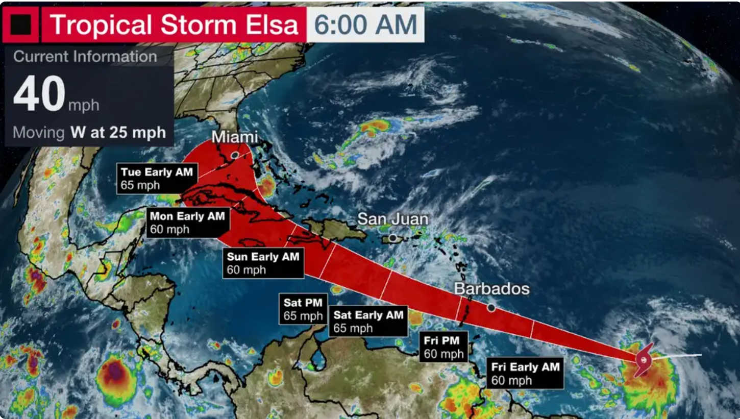
The rapidly growing weather system in the Atlantic has developed into Tropical Storm Elsa as it barrels toward the Windward Islands and southern Leeward Islands.

A tropical storm warning has been issued for St. Lucia, Barbados, St. Vincent and the Grenadines and Martinique by the National Hurricane Center, and N.H.C. said in its 5:00 a.m. Thursday forecast that interests elsewhere in the Windward Islands, Leeward Islands, the Virgin Islands, Puerto Rico, the Dominican Republic and Haiti should monitor the progress of this system.
According to N.H.C., the center of Tropical Storm Elsa was located near latitude 9.4 North, longitude 48.8 West. Elsa is moving toward the west near 25 mph (41 km/h). An even faster motion to the west-northwest is expected over the next 24 to 36 hours. On the forecast track, the system will pass near or over portions of the Windward Islands or the southern Leeward Islands on Friday, move into the eastern Caribbean Sea late Friday and Friday night, and move near the southern coast of Hispaniola on Saturday.
Maximum sustained winds have increased to near 40 mph (65 km/h) with higher gusts. Some additional strengthening is forecast during the next couple of days. Tropical-storm-force winds extend outward up to 105 miles (165 km) from the center.
The estimated minimum central pressure is 1006 mb (29.71 inches).
Key Message:
- Tropical storm conditions are beginning Friday in portions of the Windward Islands and southern Leeward Islands.
- Heavy rainfall will move quickly across the Windward and southern Leeward Islands, including Barbados, on Friday. Isolated flash flooding and mudslides are possible.
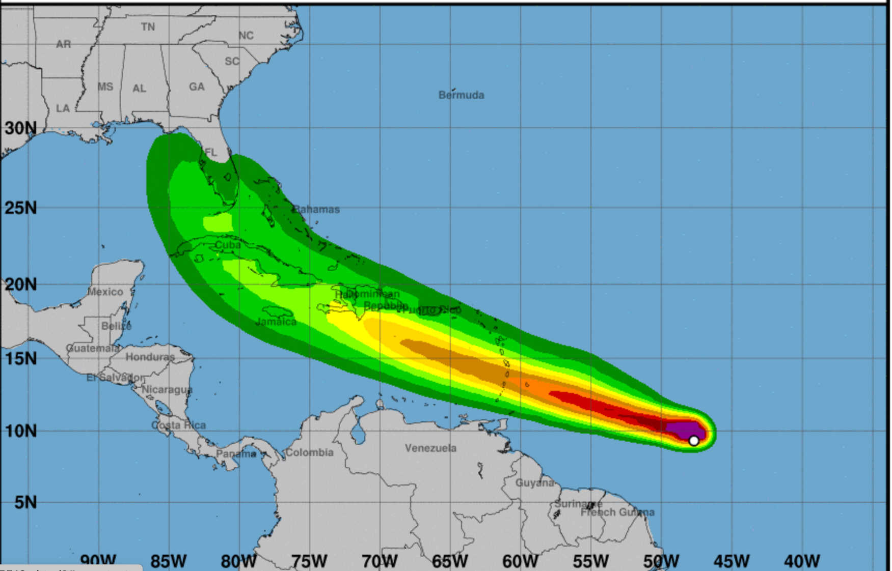
- There is a risk of wind and rainfall impacts in portions of the Virgin Islands, Puerto Rico, Hispaniola, Cuba, Turks and Caicos, and the southeastern Bahamas through early next week. Interests in these areas should monitor the system's progress and updates to the forecast.
- Interests in Florida should monitor updates to the forecast for this system, but it is too soon to determine what if any impacts could occur there next week given the uncertainty in the storm's long-range forecast.


Advertisements


