


0
A system that is expected to pass south of the Leeward Islands, including the U.S. Virgin Islands, is expected to form into a tropical depression in the coming days, according to the latest National Hurricane Center report.

In a separate report, the National Weather Service in San Juan said that based on the latest model guidance, and regardless of development, an increase in shower and thunderstorm activity is possible as early as Friday night.
"Currently, the timing of a closest approach for this system is likely between Friday night and Saturday. The National Weather Service in San Juan will continue to closely monitor the evolution of this system. If this system presents any tropical threats to Puerto Rico and the U.S. Virgin Islands, we will begin issuing daily briefings regarding anticipated hazards; though, we are not anticipating tropical threats from this system at this time," N.W.S. said.
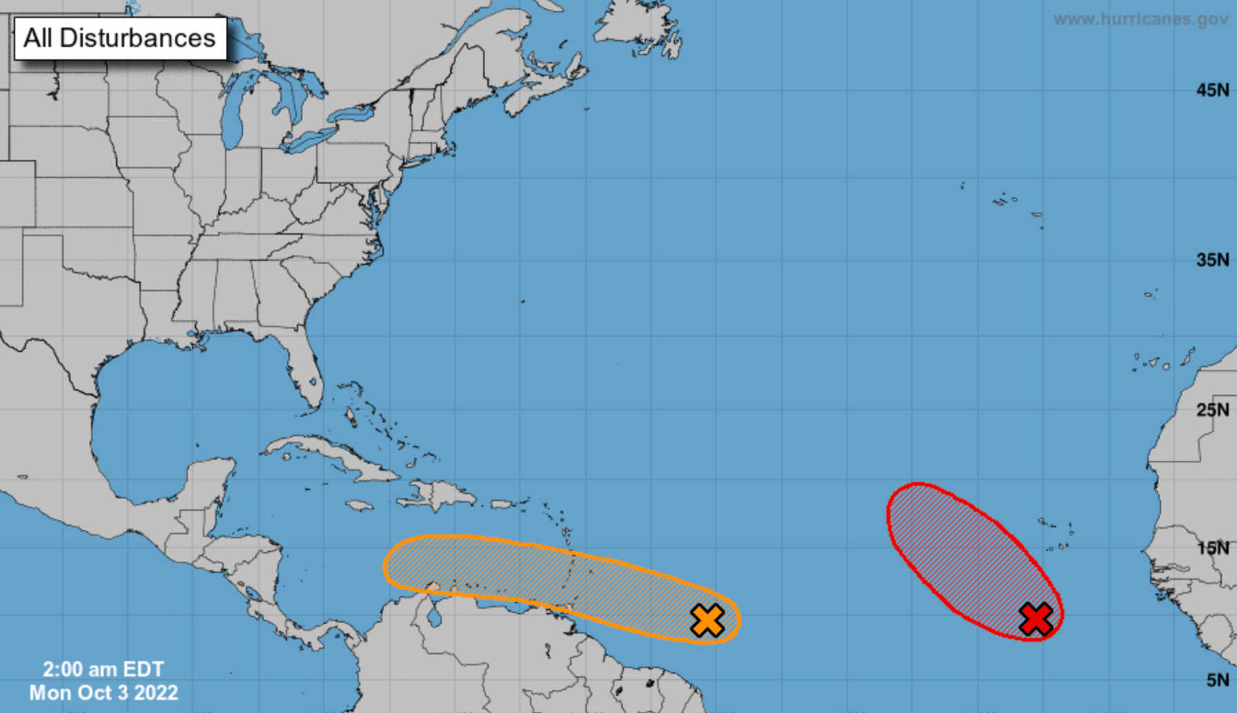
According to N.H.C.'s 5:00 a.m. Monday forecast, showers and thunderstorms associated with the tropical wave — located several hundred miles east of the Windward Islands — have changed little in organization during the past several hours. Further development of the wave is possible, however, and a tropical depression could form during the next few days while it moves generally westward at 15 to 20 mph, reaching the Windward Islands and the eastern Caribbean Sea by midweek.
Interests in the Windward Islands should monitor the progress of the system, N.H.C. advised.
The system was given a 30 percent chance of development in the next 48 hours, and 40 percent through the next five days.
A separate system is currently churning in the Atlantic, however while a tropical depression is likely to form, further development will become less likely by the end of the week due to increasing upper-level winds, N.H.C. advised.

The system is forecast to move westward, then turn northwestward or northward by the end of the week over the eastern tropical Atlantic.


Advertisements