




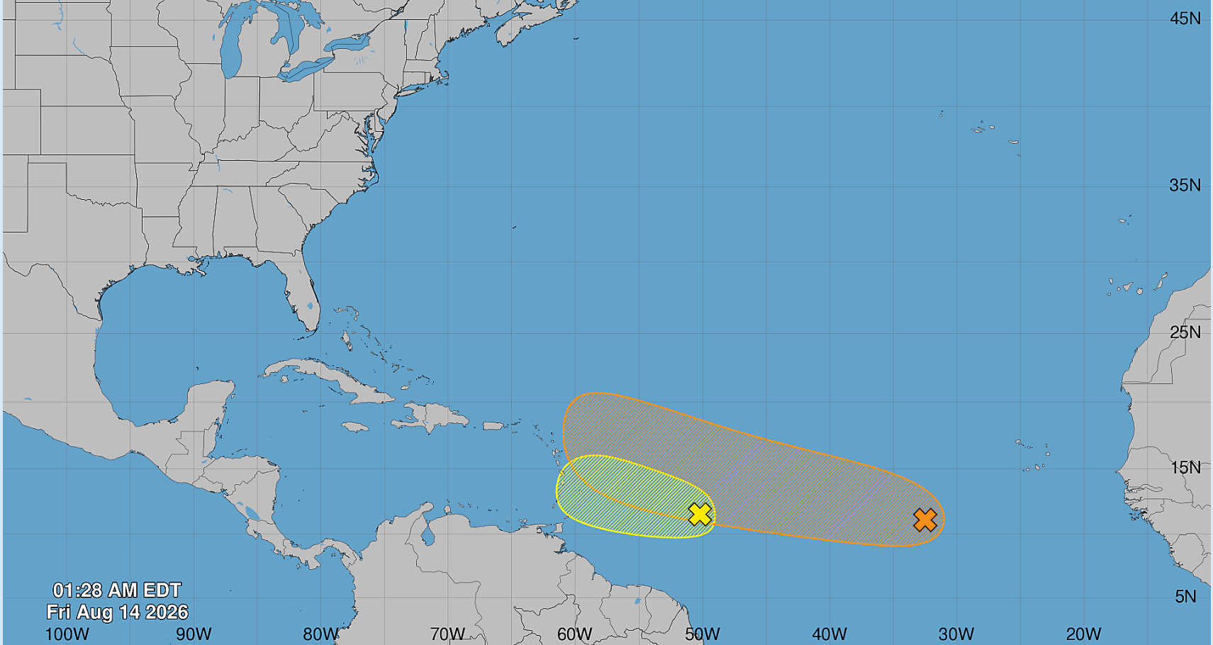
The National Hurricane Center says development is becoming less likely for a tropical wave about 650 miles east of the Lesser Antilles as the system moves into stronger upper-level winds and dry air, although gusty winds and areas of heavy rain remain possible across the islands Friday night and Saturday.

In its 2 a.m. Friday Tropical Weather Outlook, the NHC said showers and thunderstorms associated with the central tropical Atlantic wave have continued to become less organized.
The system now has a 30 percent chance of formation within 48 hours and through seven days.
Despite the declining development potential, the NHC advised interests in the Lesser Antilles to continue monitoring the system because of the potential for adverse weather as it approaches the islands.

Increasing Winds and Dry Air Limiting Development
The tropical wave was located approximately 650 miles east of the Lesser Antilles early Friday.
According to the NHC, it is entering an environment characterized by increasing upper-level winds and dry air, conditions that are making additional organization less likely.
The system’s chances of tropical cyclone formation are therefore decreasing.
Regardless of whether development occurs, however, the NHC said gusty winds and areas of heavy rainfall could affect portions of the Lesser Antilles Friday night and Saturday.
The disturbance carries a low, 30 percent chance of formation during both the two-day and seven-day forecast periods.
Second Tropical Wave Holds 50 Percent Seven-Day Chance
Farther east, the NHC continues to monitor another tropical wave located several hundred miles southwest of the Cabo Verde Islands.
That system was producing disorganized showers and thunderstorms early Friday.
Unlike the disturbance approaching the Lesser Antilles, environmental conditions around the eastern Atlantic wave are forecast to remain generally favorable for gradual development over the next several days.
The NHC said a tropical depression could form late this week or during the weekend as the wave moves westward or west-northwestward across the eastern and central tropical Atlantic.
The second disturbance has a 30 percent chance of formation within 48 hours and a 50 percent chance through seven days.

The National Hurricane Center continues to monitor both systems as they move generally westward across the tropical Atlantic.