




Low-flying aircraft will begin surveying the U.S. Virgin Islands and surrounding waters this month as the U.S. Geological Survey gathers information to improve understanding of earthquake, tsunami and landslide hazards.

The agency announced the project on November 12, saying fixed-wing aircraft will follow predetermined flight paths at a nominal terrain clearance of 330 feet, or 100 meters. Flights will take place only during daylight hours. The announcement did not specify an exact start or completion date.
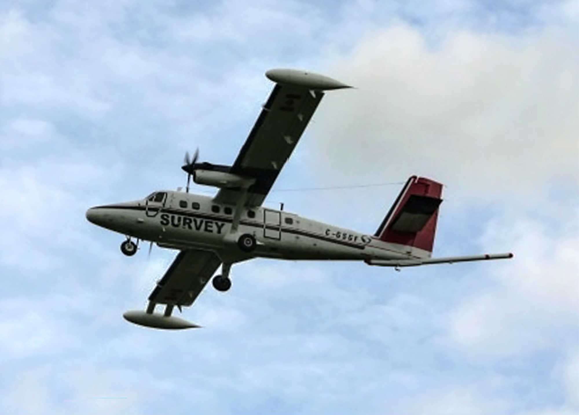
Residents may notice an elongated extension projecting from the aircraft’s tail. That equipment, described as a “stinger,” houses sensors used to collect magnetic data. USGS said the instruments are passive, produce no emissions that pose a risk to people, animals or plants, and will not collect photographs or video.
Operations will be based at Henry E. Rohlsen Airport on St. Croix, Cyril E. King Airport on St. Thomas and José Aponte de la Torre Airport in Puerto Rico. USGS identified the survey aircraft as a DHC-6-300 Twin Otter with registration C-GSGP and said it contracted Sander Geophysics and Dewberry to collect the data.

The high-resolution survey extends recent airborne mapping work over Puerto Rico. USGS said the broader region’s complex tectonic setting creates significant earthquake and tsunami hazards, and that better information about the rocks beneath surrounding shallow seas can help scientists identify active offshore faults.
The work is a scientific mapping project, not an announcement that an earthquake, tsunami or landslide is imminent. Its stated purpose is to strengthen understanding of existing geologic hazards while supporting natural-resource assessments and other research.
Brita Jessen, director of the USGS Woods Hole Coastal and Marine Science Center, said airborne magnetic mapping can help identify offshore tectonic faults and clarify the distribution of potential resources, including marine minerals.
The flight paths will be spaced according to local geology and water depth, ranging from approximately 820 feet apart over shallow water to 6,500 feet apart over deep water. Pilots will be specially trained and approved for low-level flying and will work with the Federal Aviation Administration to ensure safe operations that comply with U.S. law, according to USGS.

The project combines the agency’s Earth Mapping Resources Initiative, which modernizes geological and resource mapping, with its Coastal and Marine Hazards and Resources Program. USGS said data collected through Earth MRI are made freely available to the public through its ScienceBase platform.