




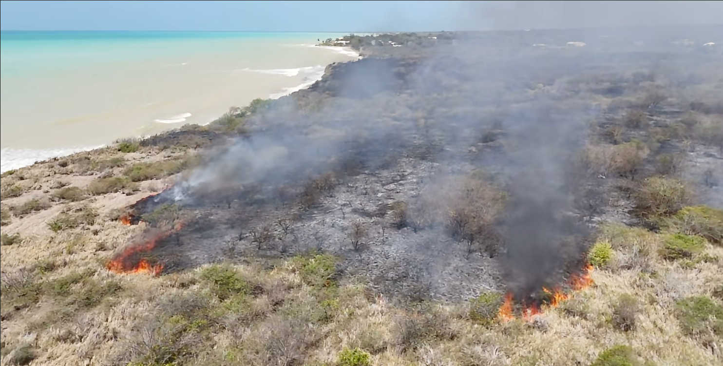
The U.S. Virgin Islands will face elevated fire danger and dangerous heat Monday, a day after a brush fire was reported on the west end of St. Croix, as the National Weather Service warns that dry conditions will continue before a tropical wave brings an increased chance of showers and thunderstorms by Wednesday.

The National Weather Service in San Juan has issued a Fire Danger Statement and Heat Advisory for the territory from 10 a.m. to 5 p.m. Monday. Forecasters said the elevated heat threat is expected to persist throughout the workweek, with heat indices climbing above 108 degrees in some areas.
The warnings follow a brush fire earlier Sunday on the west end of St. Croix. The fire occurred along the south side of the island near the beach, just beyond the Carlton stoplights.
No connection between Sunday's fire and the conditions cited in Monday's National Weather Service alert has been established. However, forecasters said Monday that dry fuels, stressed vegetation and continuing rainfall deficits are contributing to conditions capable of supporting wildfire ignition and rapid spread.

While the greatest fire-weather concern is currently across southern and southwestern Puerto Rico, the National Weather Service said elevated fire danger extends across Puerto Rico, Vieques, Culebra and the U.S. Virgin Islands. Residents and visitors are being urged to avoid outdoor burning, while the agency also warned against activities that could create sparks.
The Heat Advisory covers St. Croix, St. Thomas, St. John and adjacent islands. According to the National Weather Service, hot temperatures combined with high humidity could cause heat-related illnesses, particularly among people sensitive to heat or those without adequate cooling or hydration. Residents are advised to drink plenty of fluids, limit direct exposure to the sun and take breaks in shaded or air-conditioned areas.
On St. Croix, Monday's forecast calls for sunny conditions with a high around 94 degrees. East winds are expected around 15 mph, with gusts reaching as high as 25 mph. Tuesday is forecast to remain mostly sunny before becoming partly cloudy, with isolated showers, a high around 93 degrees and a 20 percent chance of rain.
The predominantly dry weather is expected to continue through late Tuesday, with limited shower activity across the region. The pattern is then expected to change as a tropical wave approaches from late Tuesday evening into Wednesday, bringing significantly higher atmospheric moisture and increasing the potential for widespread showers and thunderstorms across Puerto Rico and the Virgin Islands.

For St. Croix, the National Weather Service currently forecasts scattered showers Wednesday, with a 40 percent chance of rain and a high around 92 degrees. The broader forecast calls for the tropical wave to bring increased shower and thunderstorm activity, with gusty winds also possible as the system moves through the northeastern Caribbean.
Forecasters expect the heat threat to remain a concern beyond the arrival of the tropical wave, with elevated heat conditions possible through the remainder of the workweek.