




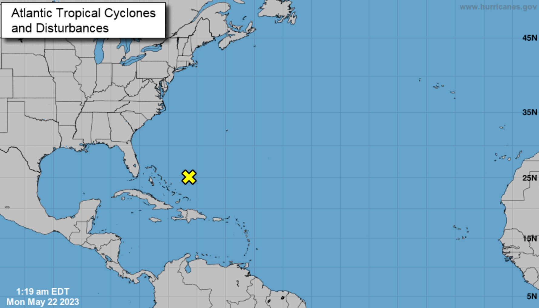
The National Weather Service's National Hurricane Center in Miami has issued a tropical weather outlook related to a tropical disturbance as the June 1 start of hurricane season approaches.

Currently, meteorologists have their eyes on a weather disturbance in the southwestern Atlantic. The system, which consists of showers and thunderstorms, is poorly organized. It is connected with a broad area of low pressure situated a few hundred miles northeast of the central Bahamas.
The conditions for this specific system are expected to prevent development into a more severe weather event. Strong upper-level winds and dry air are anticipated to hinder its evolution as the system moves generally north-northeastward at a speed of 5 to 10 mph over the southwestern Atlantic in the coming days.
The National Hurricane Center gauges the potential for tropical storm formation based on a percentage system. For this particular low-pressure system, both the 48-hour and the 7-day formation chance are assessed at a low 10 percent.
While this system seems unlikely to develop into a hurricane, it serves as a reminder that hurricane season is on the horizon. Residents in hurricane-prone areas are encouraged to begin preparing for the season and to stay informed about potential weather threats.