




The two Atlantic disturbances monitored through much of the past week have disappeared from the National Hurricane Center’s development outlook, but their underlying tropical waves have not entirely disappeared from the regional weather picture.
As of 2 a.m. Sunday, the NHC said tropical cyclone formation is not expected anywhere across the North Atlantic, Caribbean Sea or Gulf of America during the next seven days. There are also no active tropical cyclones in the Atlantic.
The National Weather Service in San Juan, however, says one tropical wave is moving through the Puerto Rico-U.S. Virgin Islands region Sunday morning, while another — the wave previously tracked as AL94 — could bring a more significant increase in moisture and rainfall late Wednesday into Thursday.
The wave currently crossing the region brought a few showers overnight to northern and eastern Puerto Rico and surrounding Atlantic and Caribbean waters, but NWS reported no significant impacts. A few fast-moving showers could continue across portions of Puerto Rico and the USVI Sunday morning as the wave moves westward and away.

A substantially drier air mass is expected behind it, accompanied by low to moderate concentrations of Saharan dust.
NWS expects atmospheric moisture to fall well below normal, with shower activity remaining limited through at least the middle of the week.
Breezy to locally windy conditions will persist Sunday before easing Monday. NWS said easterly winds at local aviation sites could reach 16 to 22 knots, with gusts as high as 30 knots.
Those winds are also contributing to rough marine conditions. Seas of 5 to 7 feet, with occasional heights of 8 to 9 feet, are expected across offshore waters and local passages Sunday, with Small Craft Advisories remaining in effect through portions of the day and evening.
A high risk of rip currents also remains in effect for the U.S. Virgin Islands through Sunday night.
Former System Could Return Rain Threat Thursday
The more notable weather potential comes later in the week from the tropical wave previously designated AL94.
Although the NHC has stopped highlighting the system for tropical development, NWS San Juan’s latest global model guidance shows the wave approaching the Caribbean and potentially moving across the local forecast area late Wednesday night into Thursday.
Forecast runs from the ECMWF and GFS show atmospheric moisture potentially rising to precipitable-water values of 2.0 to 2.2 inches, with a lower probability of reaching 2.2 to 2.4 inches.
NWS said ensemble guidance is also trending wetter for Thursday, with moisture in the lower and middle atmosphere potentially reaching levels above the climatological norm.
Under that scenario, lines of strong showers and thunderstorms could move across windward portions of the islands throughout Thursday.
Rainfall could become sufficient to produce ponding on roadways and in poorly drained locations, along with minor flooding, according to the forecast discussion.
Forecast Still Carries High Uncertainty
NWS stressed that considerable uncertainty remains surrounding the Thursday forecast.
The former disturbance will encounter conditions that are unfavorable for tropical development, including dry air, Saharan dust and strong wind shear. Those factors could also influence how much moisture and rainfall ultimately reach the islands.
That distinction is important: the NHC no longer sees a tropical cyclone threat from the systems, but that does not mean their associated tropical waves cannot produce rainfall, thunderstorms and gusty conditions. The NHC’s Sunday outlook addresses cyclone formation, while the San Juan forecast continues to track the waves' potential local weather effects.
NWS specifically advises residents and visitors to continue monitoring the former AL94 wave despite its removal from the NHC development outlook.
Once that wave moves through, another dry slot and Saharan dust are expected to enter the region, sending atmospheric moisture back below normal. Another trade-wind disturbance and an upper-level low could then raise shower and thunderstorm chances again by Saturday.
Heat, Fire and Coastal Hazards Sunday
In the immediate term, weather hazards across the USVI Sunday are less about tropical development and more about heat, wind, rough seas and dry conditions.
A Heat Advisory is in effect for the U.S. Virgin Islands from 10 a.m. to 5 p.m. Sunday, with NWS warning of an elevated risk for heat exhaustion, particularly among heat-sensitive residents and people working outdoors.
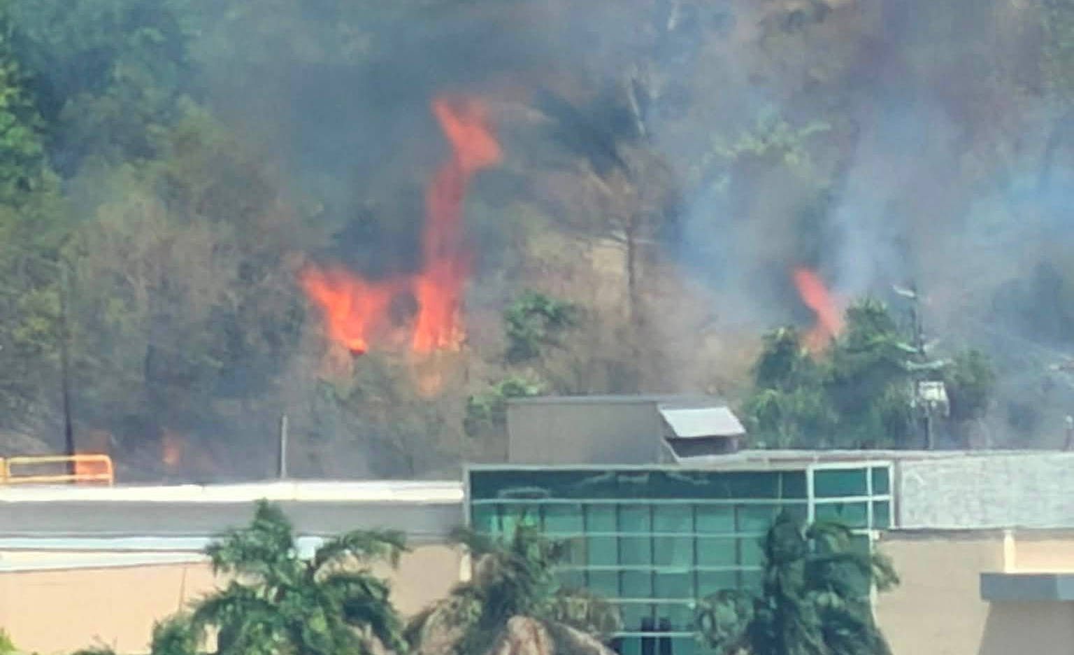
NWS has also issued a Fire Danger Statement for the USVI from 10 a.m. through 5 p.m. Strong easterly winds, low humidity, dry soils, stressed vegetation and existing rainfall deficits are creating conditions favorable for rapid fire spread. Residents are being urged to avoid outdoor burning and activities that could create sparks.

For the remainder of the week, the main period to watch is late Wednesday into Thursday, when the remnants of the second Atlantic disturbance could again raise moisture levels and bring stronger showers and thunderstorms across the local islands despite having little or no prospect of becoming a tropical cyclone.