


ST. CROIX — The National Weather Service (NWS) in San Juan has issued both a Hazardous Weather Outlook and a Heat Advisory for the U.S. Virgin Islands on Tuesday, September 23, warning residents of thunderstorms, flooding, extreme heat, and marine hazards as a tropical wave nears the region.

Hazardous Weather Outlook
The NWS said isolated to scattered thunderstorms, particularly over the Atlantic waters near St. Thomas and St. John, could bring frequent lightning. Residents are advised to stop all outdoor activities and seek shelter if storms develop.
Excessive rainfall is also a concern. Urban areas, roads, small streams, and washes could see flooding overnight. While the chance of isolated flash floods is low, water ponding is likely in poorly drained areas.
Dangerous heat remains another hazard. According to the NWS, heat levels could impact most individuals sensitive to high temperatures, especially those without proper cooling or hydration. The highest risks apply to those extremely sensitive to heat, with possible effects on health systems and heat-sensitive industries.
Marine conditions also warrant caution. Small craft should exercise care across offshore Atlantic waters. In addition, life-threatening rip currents are possible along the surf zone, with stronger rip currents possible near piers, jetties, and channels.
Looking ahead, rainfall risks are expected to rise by midweek with the arrival of a robust tropical wave. Hazardous marine conditions could develop by Wednesday, along with continued rip current risks. Dangerous heat is expected to return by the end of the week into the weekend.
The NWS encouraged residents to act as spotters, reporting any information about flooding, winds, waves, or rip currents to the San Juan office.
Heat Advisory
The NWS issued a Heat Advisory in effect from 10 a.m. to 4 p.m. Tuesday for all urban and coastal areas, as well as the eastern interior of Puerto Rico, Vieques, Culebra, and the U.S. Virgin Islands.
Tropical Wave Update from NHC
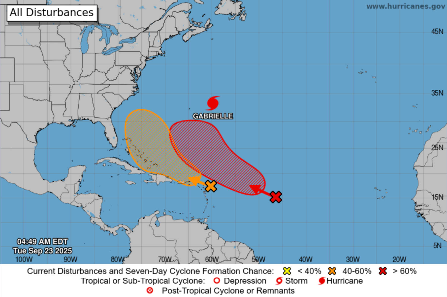
At 2 a.m. on September 23, the National Hurricane Center reported that a tropical wave about 100 miles east of the Leeward Islands was producing concentrated but disorganized showers and thunderstorms.
The wave is moving west to west-northwest at 15 to 20 mph. While environmental conditions are only marginally favorable, slow development is possible later this week as the system slows and turns northwestward over the southwestern Atlantic or near the Bahamas.
Regardless of development, gusty winds and heavy rainfall are expected to affect portions of the Leeward Islands late Tuesday and Puerto Rico and the Virgin Islands late Tuesday into Wednesday.
-
Formation chance through 48 hours: 10 percent (low)
-
Formation chance through 7 days: 50 percent (medium)
Summary

Residents of the Virgin Islands should prepare for thunderstorms, potential flooding, dangerous heat, rip current risks, and marine hazards on Tuesday. With a tropical wave moving toward the region, unsettled weather will continue into midweek. Officials advise remaining alert to advisories from the NWS and NHC, avoiding heat exposure during peak hours, and taking precautions near coastal waters.


Advertisements


