


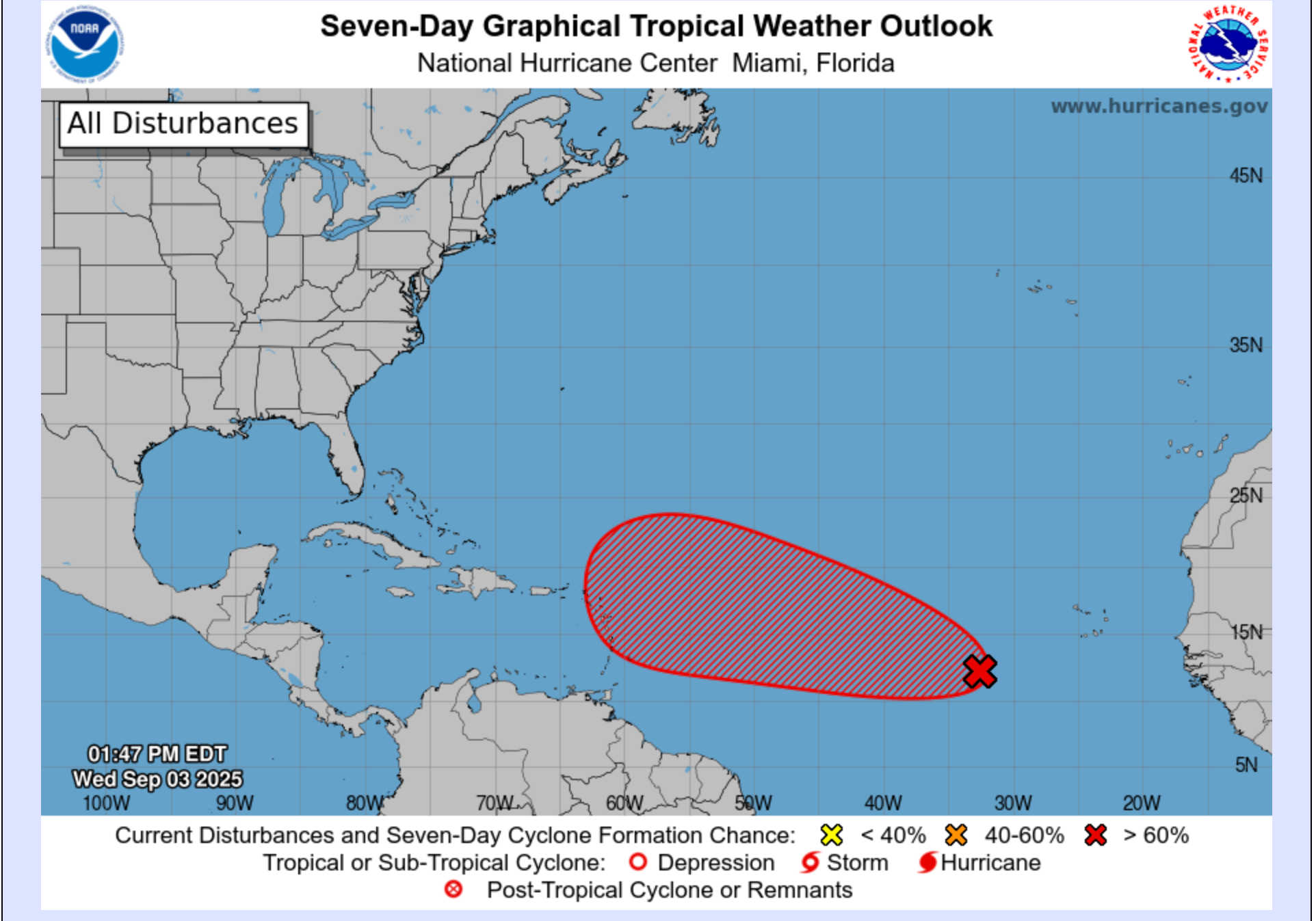
The NHC graphic shows a disturbance in the eastern Atlantic with a high chance of development over the next seven days, moving west-northwest from near the Cabo Verde Islands toward the central Atlantic. Photo Credit: NHC.
Forecasters are paying close attention to a tropical wave located a few hundred miles west-southwest of the Cabo Verde Islands as the Atlantic hurricane season moves into its peak. While still disorganized, the system shows signs that it could develop into a tropical depression later this week, and its potential track has drawn interest in the Leeward Islands, the U.S. Virgin Islands, and Puerto Rico.

The National Hurricane Center (NHC) said Wednesday evening that the disturbance is moving west to west-northwest at about 15 mph. Showers and thunderstorms remain scattered, but conditions are favorable for strengthening. Development odds remain at 40 percent over the next 48 hours and rise to 80 percent through seven days.
Forecast models generally carry the system across the eastern and central Atlantic into early next week. While most European ensemble guidance keeps the disturbance well north of the Leeward Islands, recent operational runs of both the GFS and European models tracked the system farther south, closer to the Lesser Antilles. The European and Google DeepMind models also show slower development than the American GFS, leaving uncertainty in both timing and path.
If the system strengthens and edges nearer to the islands, forecasters warn it could bring rough surf, high swells, and potentially heavy rain by the middle of next week. If it remains further north, impacts may be limited to increased surf and rip-current risks.
Here's this evening’s local update with observations taken around 6:45 p.m. AST on September 3.
-
Charlotte Amalie – St. Thomas: Fair skies at 84°F, north winds around 14 mph with gusts up to 17 mph, pressure at 29.95 inHg, humidity at 73 percent, and visibility of 10 miles. Tonight’s forecast calls for some clouds, a low near 81°F, and a 24 percent chance of rain. Thursday will bring highs of 90°F with sunshine and clouds mixed, an 8 percent chance of precipitation, and east-southeast winds at 10–20 mph.
-
Christiansted – St. Croix: Fair skies at 83°F, north winds around 4 mph gusting to 11 mph, pressure at 29.94 inHg, humidity at 72 percent, and visibility of 10 miles. Tonight will be partly cloudy with lows near 78°F and about a 10 percent chance of rain. Thursday’s high will reach 90°F, with a 23 percent chance of precipitation and easterly winds at 10–20 mph.
-
St. John: Showers in the vicinity at 80°F, light north winds near 3 mph gusting to 11 mph, pressure at 29.95 inHg, humidity at 72 percent, and visibility of 10 miles. Tonight’s forecast is partly cloudy with a low of 77°F and a 24 percent chance of precipitation. Thursday is expected to be partly cloudy with breezy easterly winds.

The National Oceanic and Atmospheric Administration (NOAA) continues to forecast an above-normal 2025 Atlantic hurricane season, with 13 to 19 named storms, six to 10 hurricanes, and three to five major hurricanes. The Accumulated Cyclone Energy (ACE) index is projected at 95 to 180 percent of the median, with a 60 percent probability of an above-normal season.


Advertisements


