


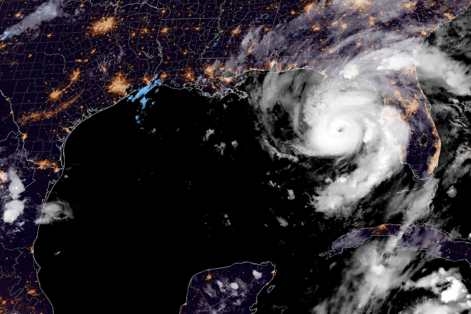
A satellite snapshot captures Hurricane Idalia nearing Florida's west coast on Tuesday evening. By. NOAA.
Florida is under siege as Hurricane Idalia intensifies to a Category 4 storm, with maximum sustained winds of 130 mph, according to the National Weather Service. The storm, currently about 60 miles west of Cedar Key and 90 miles south of Tallahassee, is advancing at 18 mph and threatens to bring catastrophic storm surges and destructive winds to Florida's Big Bend Region.

Multiple advisories are in effect, covering areas well beyond Florida. A Hurricane Warning extends from Altamaha Sound, Georgia to Edisto Beach, South Carolina. Storm Surge Warnings are in place from St. Catherine's Sound to South Santee River, affecting parts of Georgia and South Carolina. Tropical Storm Warnings have been issued from North of Surf City, North Carolina, to the North Carolina/Virginia border, including Pamlico and Albemarle Sounds.
The Tropical Storm Warning previously in effect for Florida's west coast from Bonita Beach southward has been discontinued.
Storm Path and Outlook
The hurricane is expected to make landfall in Florida's Big Bend region this morning, with the potential for further intensification before landfall. After that, the system is forecasted to move near or along the coasts of Georgia, South Carolina, and North Carolina. Although expected to weaken after making landfall, Idalia is likely to remain a hurricane as it moves across southern Georgia and along the coast of Georgia or southern South Carolina.
Land Hazards
-
Storm Surge: Coastal areas in Florida could see surges ranging from 3 to 16 feet, depending on the location. Areas from Wakulla/Jefferson County, FL to Yankeetown, FL, could experience surges of 12-16 feet.
-
Wind: Hurricane conditions are imminent within the hurricane warning area in Florida. The winds are also expected to affect the coasts of Georgia and South Carolina later today.
-
Rainfall: Areas from Florida's Big Bend through central Georgia and South Carolina, and eastern North Carolina could see 4 to 8 inches of rainfall, with isolated areas receiving up to 12 inches. This could lead to flash, urban, and moderate river flooding.
-
Tornadoes: A few tornadoes are possible, initially across west-central and northern Florida, and later extending into southeast Georgia and the coastal Carolinas.
Officials have warned that this is a life-threatening situation and urge residents to promptly follow evacuation and other instructions from local authorities.

For more information, including updates specific to your area, monitor advisories from your local National Weather Service office.


