
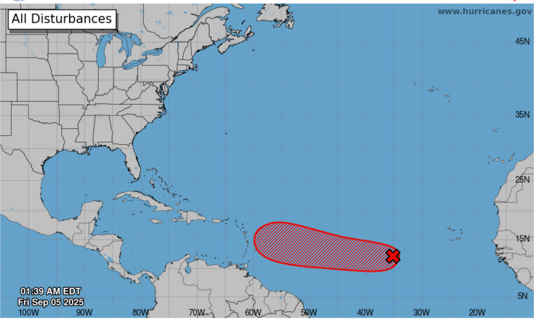
The National Hurricane Center’s 2 a.m. EDT update on Friday, September 5, continued to track Invest AL91, a broad low-pressure system linked to a tropical wave in the eastern Atlantic. While still disorganized, the disturbance is producing showers and thunderstorms north of its center, and forecasters say conditions remain favorable for strengthening.

The outlook kept formation odds steady at 60 percent within 48 hours and 90 percent within seven days. A tropical depression is likely to form by the weekend. The system is moving slowly west at 5–10 mph and is expected to approach the Lesser Antilles by the middle to latter part of next week.
The NHC advised residents of the Leeward Islands, including the U.S. Virgin Islands, to monitor the disturbance closely.
Current Morning Conditions
At 6:00 a.m. AST on Friday, weather across the region showed varied conditions:
-
Charlotte Amalie, St. Thomas (6:09 a.m.): 82°F, sunny with a light north wind at 5 mph, gusting to 11 mph. Pressure 29.99 inHg, humidity 81 percent. Forecast calls for heavy morning thunderstorms with up to 3–5 inches of rain, then partly cloudy by afternoon. High near 90°F, winds east 10–20 mph. Tonight: partly cloudy, low 82°F. Saturday: passing shower early, partly cloudy later; high 89°F with 30 percent chance of rain.
-
Cruz Bay, St. John (6:08 a.m.): 80°F, fair skies, north winds at 10 mph, humidity 82 percent. Thunderstorms expected with 1–2 inches of rain, high near 87°F. Tonight: mostly cloudy early, then partly cloudy, low 78°F. Saturday: showers in the morning, partly cloudy later, high 86°F with 50 percent chance of rain.
-
Christiansted, St. Croix (6:15 a.m.): 80°F, partly cloudy, very light north wind at 2 mph (gusts 5 mph), pressure 29.98 inHg, humidity 85 percent. Forecast: morning rain with 70 percent chance of showers, high near 88°F. Tonight: cloudy early, then partly cloudy, low 78°F. Saturday: sun and clouds mix, high 88°F with 20 percent chance of rain.
-
San Juan, Puerto Rico (6:08 a.m.): 81°F, partly cloudy, calm winds, pressure ~30.00 inHg, humidity 82 percent. Forecast: cloudy with scattered showers, high near 89°F with 50 percent chance of rain (0.30 in expected). Tonight: partly cloudy, low 79°F. Saturday: mostly cloudy, high 88°F with 20 percent chance of rain.
Regional Forecast
-
Friday (Sep 5): Widespread showers and thunderstorms fueled by a weak tropical wave and moisture from AL91. Heavy rain possible on St. Thomas and St. John with totals of several inches. Winds east 10–20 mph.
-
Saturday (Sep 6): Showers taper off, partly cloudy by afternoon. Highs in the upper 80s, easterly winds 10–20 mph.
-
Sunday (Sep 7): Mostly sunny to partly cloudy with isolated showers. Swells from the disturbance begin reaching east-facing coasts, raising surf and rip-current risks.
-
Monday (Sep 8): Moisture increases as AL91 nears longitude 50–55°W. Scattered showers and thunderstorms possible. Swells continue to build.
-
Tuesday (Sep 9): Disturbance expected near or just north of the Leeward Islands. Most models keep the center north, but if the track shifts south, heavy rain and gusty winds could affect the Leewards, USVI, and eastern Puerto Rico.

With the peak of hurricane season underway, even systems that stay north can produce dangerous conditions across the Caribbean.


