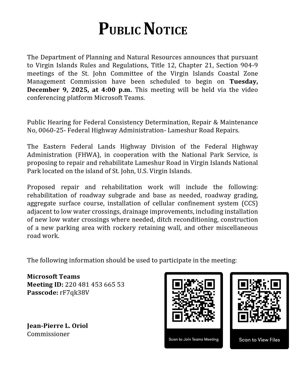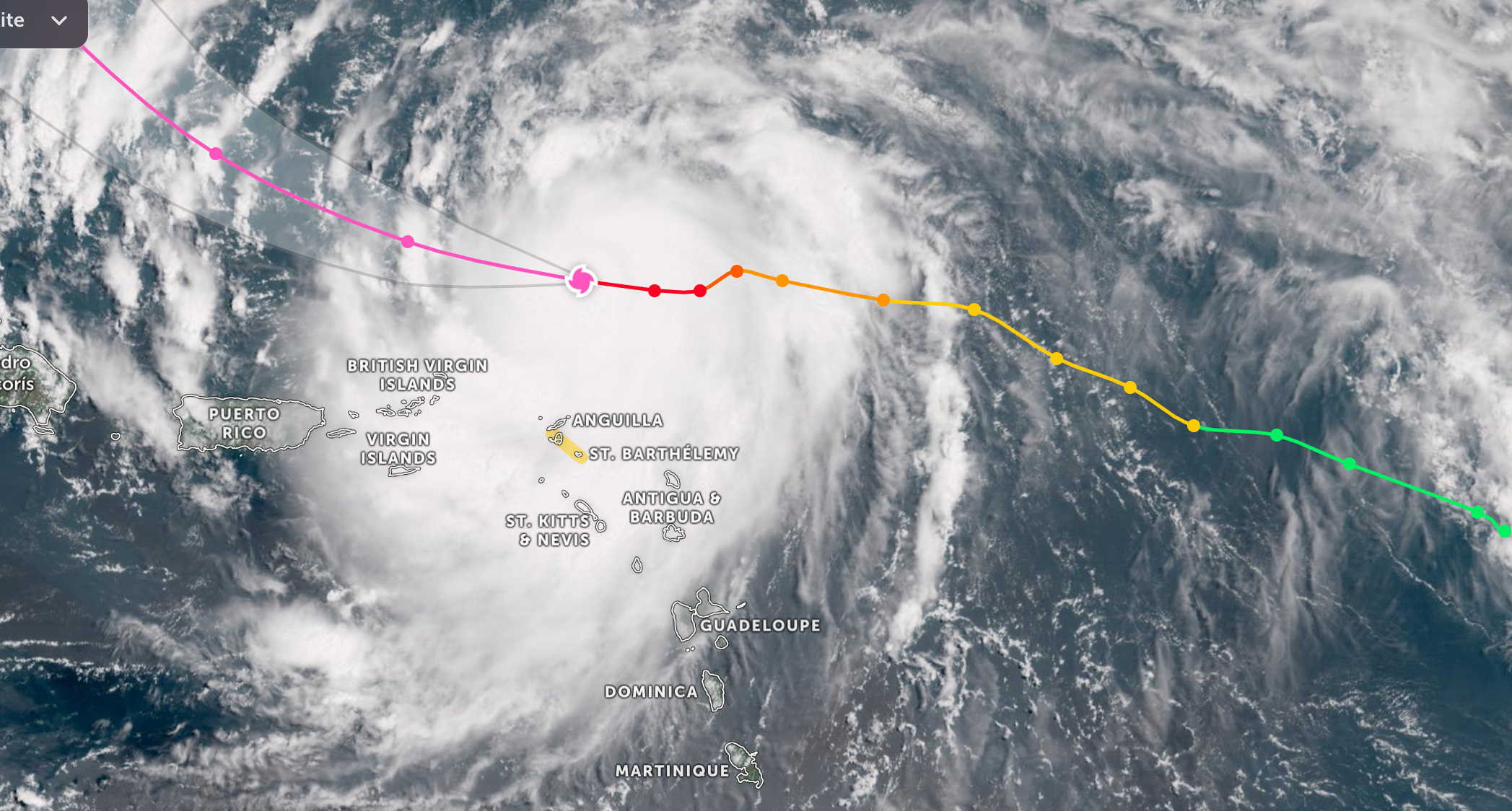
The National Weather Service in San Juan reports that Hurricane Erin has strengthened into a powerful Category 5 system as it moves closer to Puerto Rico and the U.S. Virgin Islands, posing multiple hazards to the region over the weekend.

At 11 a.m., the center of Hurricane Erin was located about 235 miles east-northeast of San Juan, Puerto Rico, traveling west at 17 mph. Forecasters said Erin is undergoing rapid intensification and is expected to strengthen further in the coming hours.
The storm’s closest approach is projected for early Sunday morning, when Erin is forecast to pass approximately 120 miles north-northeast of St. Thomas, U.S. Virgin Islands, and about 145 miles north-northeast of San Juan, Puerto Rico.
Authorities warn residents and visitors across Puerto Rico, Vieques, Culebra, and the U.S. Virgin Islands to prepare for significant impacts:
-
Rip Currents and Coastal Flooding: Large breaking waves of 10 to 15 feet are forecast to produce life-threatening rip currents, beach erosion, and minor coastal flooding along north- and east-facing beaches. A High Rip Current Risk and High Surf Advisory remain in effect through Monday morning.
-
Marine Conditions: Seas of 10 to 15 feet will create dangerous conditions across the Atlantic and Caribbean waters, including the Anegada Passage and most local passages, through late Sunday night. Small Craft Advisories remain in effect through Monday morning.
-
Winds: Sustained winds of 25 to 35 mph, with gusts up to 45 mph, are expected, particularly during heavy showers and outer rainbands.
-
Rainfall and Flooding: Showers and thunderstorms will increase from Saturday afternoon into early next week. Rainfall totals of 2 to 4 inches are expected, with isolated amounts up to 6 to 8 inches possible. A Flood Watch is in effect through Monday evening.

The National Weather Service will issue the next briefing at 8 a.m. AST on Sunday, August 17, or earlier if conditions warrant.